Santa Venera night lights from space
Night Light of Santa Venera (Saint Venera) from space (Malta) Src. Average luminocity for 10x10km area is 85.9872% and for 50x50km: 10.3811%.
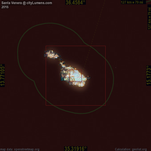
Analysis of Santa Venera night lights 2016
Square area 10x10 km:
 32.23%
90-99
30.95%80-89
8.06%70-79
7.69%60-69
11.17%50-59
1.83%40-49
2.38%30-39
1.83%20-29
3.66%10-19
0.18%0-9
0%Square area 50x50 km:
1.79%90-99
2%80-89
1.14%70-79
1.4%60-69
1.94%50-59
0.68%40-49
1.13%30-39
1.39%20-29
2.55%10-19
5.97%0-9
80.03%Clear (daylight) street map image can be seen on geolist.org.
Map coordinates:
36° 27' 30.2" North, 13° 46' 15.8" East
35° 53' 27" North, 14° 28' 27" East
35° 19' 9" North, 15° 10' 38.3" East
Some cities around Santa Venera sort by population:
• Birkirkara
1.4 km =0.9 mi,  301°
301°
• Qormi
1.7 km =1.1 mi,  186°
186°
• Saint John
1.6 km =1 mi,  6°
6°
• Ħamrun
1.1 km =0.7 mi,  126°
126°
• Imsida
0.8 km =0.5 mi,  76°
76°
• Pietà
1.9 km =1.2 mi, 77°
• Balzan
2 km =1.2 mi, 301°
• Ta’ Xbiex
2 km =1.2 mi,  63°
63°
2562518 (p: 6,264)
Sources (retrieved 2019-11-25):
» Earth at Night: Flat Maps 2012, 2016