Ulan Bator night lights from space
Night Light of Ulan Bator (Ulaanbaatar) from space (Mongolia) Src. Average luminocity for 10x10km area is 75.4063% and for 50x50km: 9.3645%.
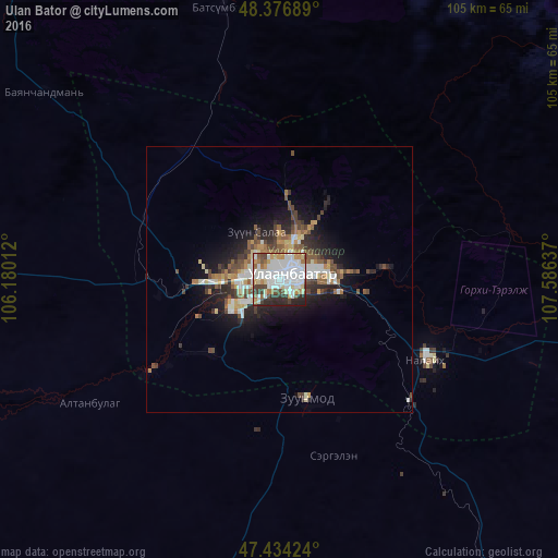
Analysis of Ulan Bator night lights 2016
Square area 10x10 km:
 33.38%
90-99
17.19%80-89
6.39%70-79
6.53%60-69
7.81%50-59
3.27%40-49
8.24%30-39
5.54%20-29
10.8%10-19
0.85%0-9
0%Square area 50x50 km:
1.88%90-99
1.7%80-89
0.84%70-79
0.87%60-69
1.15%50-59
1.3%40-49
1.82%30-39
1.14%20-29
2.71%10-19
4.99%0-9
81.6%Clear (daylight) street map image can be seen on geolist.org.
Map coordinates:
48° 22' 36.8" North, 106° 10' 48.4" East
47° 54' 27.8" North, 106° 52' 59.7" East
47° 26' 3.3" North, 107° 35' 10.9" East
Some cities around Ulan Bator sort by population:
• Erdenet
241.4 km =150 mi,  301°
301°
• Darhan
189.2 km =117.6 mi,  338°
338°
• Sühbaatar
263 km =163.4 mi,  349°
349°
• Dzüünharaa
109.6 km =68.1 mi, 343°
• Зуунмод
22.9 km =14.2 mi,  166°
166°
• Mandalgovi
243 km =151 mi,  191°
191°
• Dzuunmod
22.9 km =14.2 mi, 166°
• Choyr
205.1 km =127.4 mi,  146°
146°
2028462 (p: 844,818)
Sources (retrieved 2019-11-25):
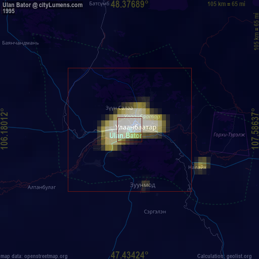
» NASA, Earths city lights 1995
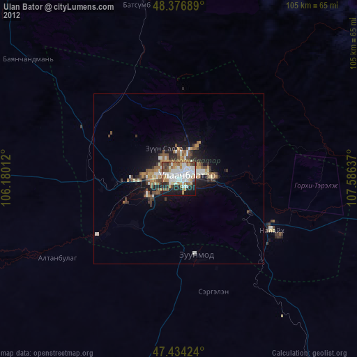
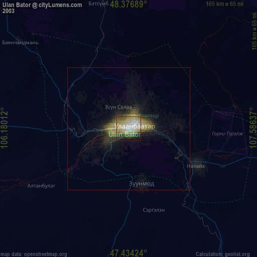
» NASA city lights 2003
» Earth at Night: Flat Maps 2012, 2016