Syriam night lights from space
Night Light of Syriam (Rangoon) from space (Myanmar) Src. Average luminocity for 10x10km area is 61.2662% and for 50x50km: 26.385%.
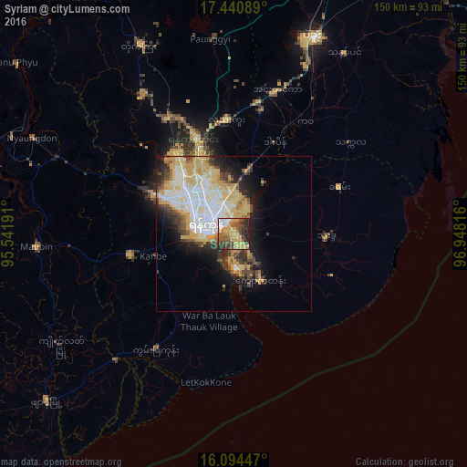
Analysis of Syriam night lights 2016
Square area 10x10 km:
 6.28%
6.28%90-99
4.76%80-89
11.69%70-79
22.29%60-69
6.28%50-59
12.77%40-49
15.8%30-39
7.79%20-29
11.69%10-19
0.65%0-9
0%Square area 50x50 km:
5.21%90-99
5.87%80-89
5.79%70-79
4.66%60-69
1.5%50-59
2.13%40-49
3.4%30-39
2.77%20-29
4.36%10-19
6.95%0-9
57.37%Clear (daylight) street map image can be seen on geolist.org.
Map coordinates:
17° 26' 27.2" North, 95° 32' 30.9" East
16° 46' 7.9" North, 96° 14' 42.1" East
16° 5' 40.1" North, 96° 56' 53.4" East
Some cities around Syriam sort by population:
• Yangon
10.3 km =6.4 mi,  293°
293°
• Bago
67.8 km =42.1 mi,  21°
21°
• Kanbe
26.8 km =16.7 mi,  255°
255°
• Thongwa
29.8 km =18.5 mi,  91°
91°
• Kyaiklat
66.2 km =41.1 mi,  237°
237°
• Maubin
63 km =39.1 mi,  266°
266°
• Twante
34.3 km =21.3 mi, 259°
• Kayan
37 km =23 mi,  65°
65°
1295395 (p: 69,448)
Sources (retrieved 2019-11-25):
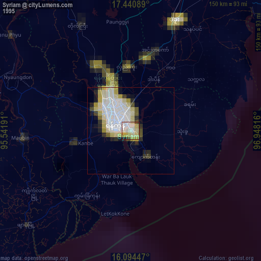
» NASA, Earths city lights 1995
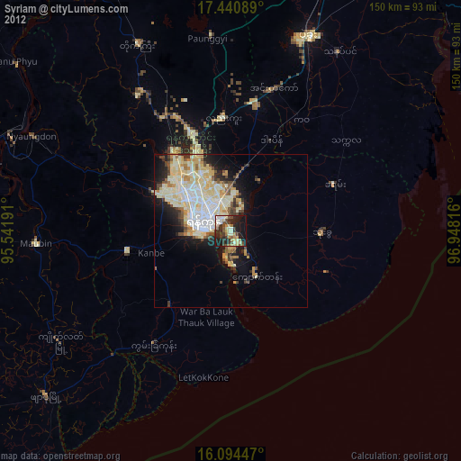
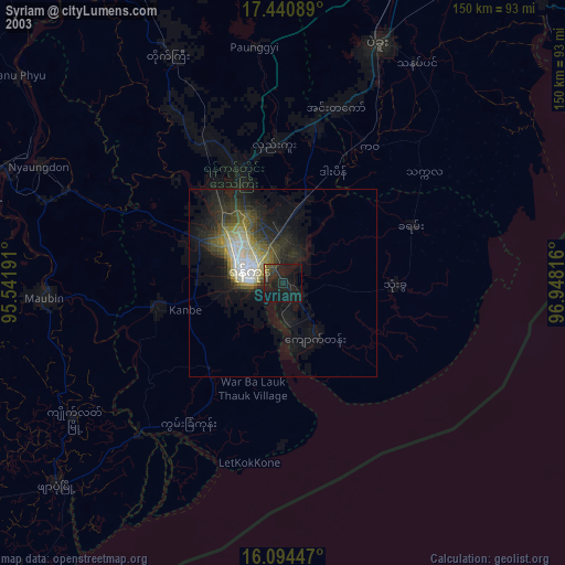
» NASA city lights 2003
» Earth at Night: Flat Maps 2012, 2016