Kanbe night lights from space
Night Light of Kanbe (Rangoon) from space (Myanmar) Src. Average luminocity for 10x10km area is 0.9957% and for 50x50km: 16.9079%.
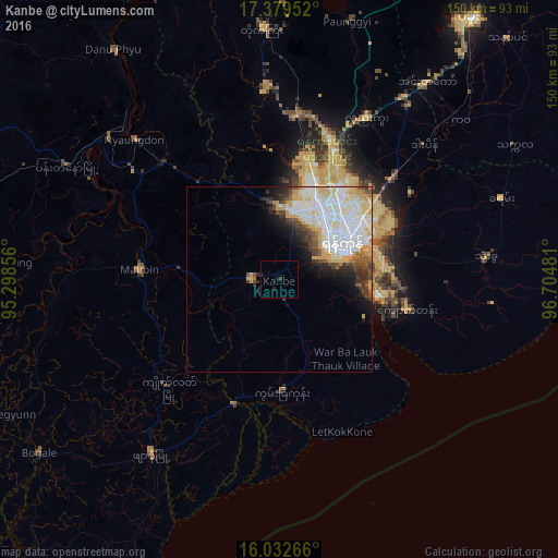
Analysis of Kanbe night lights 2016
Square area 10x10 km:
 0%
0%90-99
0%80-89
0%70-79
0%60-69
0%50-59
0%40-49
0%30-39
0.87%20-29
0.87%10-19
0.65%0-9
97.62%Square area 50x50 km:
4.85%90-99
5.15%80-89
2.67%70-79
1.74%60-69
0.59%50-59
1.13%40-49
1.62%30-39
1.57%20-29
2.13%10-19
3.2%0-9
75.37%Clear (daylight) street map image can be seen on geolist.org.
Map coordinates:
17° 22' 46.3" North, 95° 17' 54.8" East
16° 42' 26.2" North, 96° 0' 6" East
16° 1' 57.6" North, 96° 42' 17.3" East
Some cities around Kanbe sort by population:
• Yangon
19.7 km =12.2 mi,  56°
56°
• Syriam
26.8 km =16.7 mi,  75°
75°
• Pyapon
58.2 km =36.2 mi,  216°
216°
• Thongwa
56 km =34.8 mi, 83°
• Kyaiklat
41.6 km =25.8 mi,  225°
225°
• Maubin
37.1 km =23.1 mi,  274°
274°
• Twante
7.8 km =4.8 mi, 272°
• Nyaungdon
53.8 km =33.4 mi,  314°
314°
1320944 (p: 58,146)
Sources (retrieved 2019-11-25):
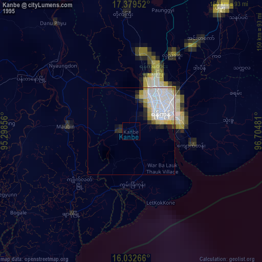
» NASA, Earths city lights 1995
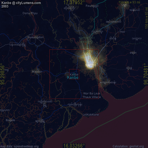
» NASA city lights 2003
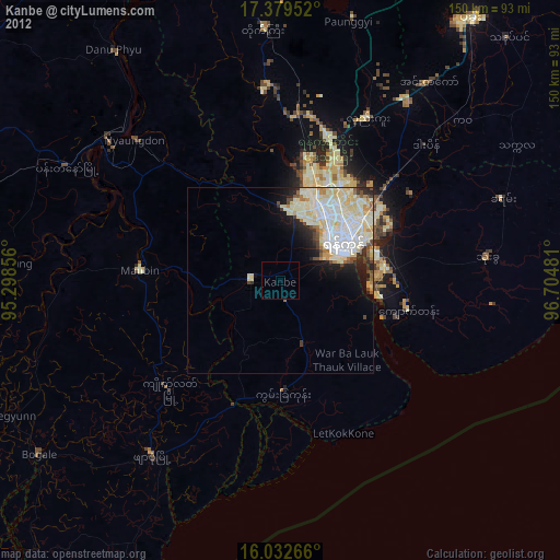
» Earth at Night: Flat Maps 2012, 2016