Pyin Oo Lwin night lights from space
Night Light of Pyin Oo Lwin (Mandalay) from space (Myanmar) Src. Average luminocity for 10x10km area is 29.2956% and for 50x50km: 2.0194%.
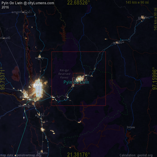
Analysis of Pyin Oo Lwin night lights 2016
Square area 10x10 km:
 1.39%
1.39%90-99
3.17%80-89
9.72%70-79
2.18%60-69
6.15%50-59
2.78%40-49
4.56%30-39
2.98%20-29
2.98%10-19
30.95%0-9
33.13%Square area 50x50 km:
0.06%90-99
0.18%80-89
0.48%70-79
0.09%60-69
0.27%50-59
0.28%40-49
0.44%30-39
0.56%20-29
0.29%10-19
1.6%0-9
95.75%Clear (daylight) street map image can be seen on geolist.org.
Map coordinates:
22° 41' 6.9" North, 95° 45' 13.4" East
22° 2' 6" North, 96° 27' 24.6" East
21° 22' 54.3" North, 97° 9' 35.9" East
Some cities around Pyin Oo Lwin sort by population:
• Mandalay
39.1 km =24.3 mi,  260°
260°
• Monywa
136.4 km =84.8 mi,  273°
273°
• Meiktila
142.8 km =88.7 mi,  205°
205°
• Myingyan
127.5 km =79.2 mi,  239°
239°
• Mogok
98.3 km =61.1 mi,  3°
3°
• Shwebo
98.1 km =61 mi,  307°
307°
• Sagaing
52.2 km =32.4 mi,  250°
250°
• Kyaukse
58.2 km =36.2 mi, 214°
1309937 (p: 117,303)
Sources (retrieved 2019-11-25):
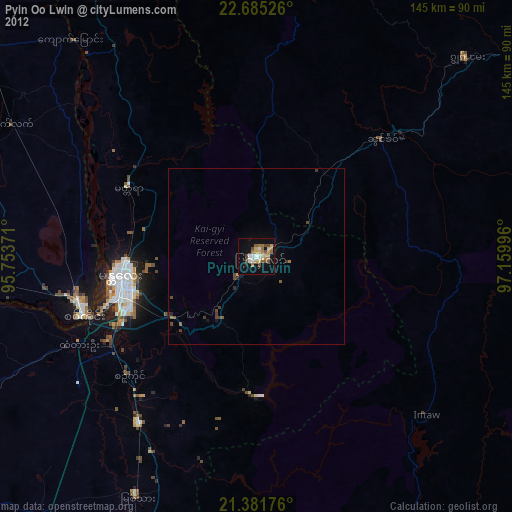
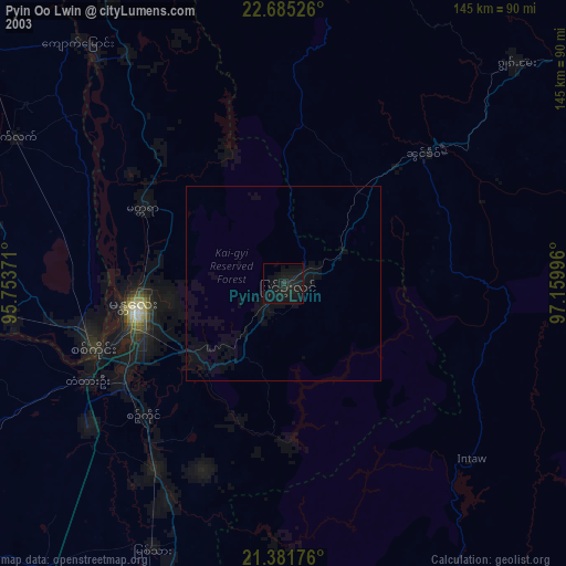
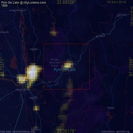
» NASA, Earths city lights 1995
» NASA city lights 2003
» Earth at Night: Flat Maps 2012, 2016