Mawlamyine night lights from space
Night Light of Mawlamyine (Mon) from space (Myanmar) Src. Average luminocity for 10x10km area is 39.2748% and for 50x50km: 3.4673%.
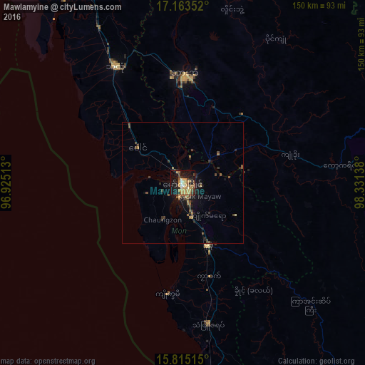
Analysis of Mawlamyine night lights 2016
Square area 10x10 km:
 1.24%
1.24%90-99
4.13%80-89
5.99%70-79
18.6%60-69
2.69%50-59
5.37%40-49
4.34%30-39
4.75%20-29
7.23%10-19
34.3%0-9
11.36%Square area 50x50 km:
0.05%90-99
0.17%80-89
0.38%70-79
0.94%60-69
0.35%50-59
0.58%40-49
0.99%30-39
0.64%20-29
0.82%10-19
3.04%0-9
92.05%Clear (daylight) street map image can be seen on geolist.org.
Map coordinates:
17° 9' 48.7" North, 96° 55' 30.5" East
16° 29' 25.8" North, 97° 37' 41.7" East
15° 48' 54.5" North, 98° 19' 53" East
Some cities around Mawlamyine sort by population:
• Kyain Seikgyi Township
99.8 km =62 mi,  138°
138°
• Thaton
55 km =34.2 mi,  329°
329°
• Mudon
28 km =17.4 mi,  158°
158°
• Hpa-An
44.4 km =27.6 mi,  0°
0°
• Martaban
4.4 km =2.7 mi,  342°
342°
• Kyaikkami
46.5 km =28.9 mi,  188°
188°
• Myawadi
96.4 km =59.9 mi,  76°
76°
• Mae Sot, TH
103.1 km =64.1 mi, 75°
1308465 (p: 438,861)
Sources (retrieved 2019-11-25):
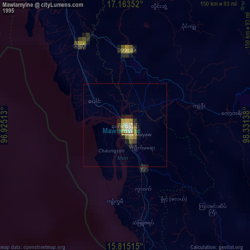
» NASA, Earths city lights 1995
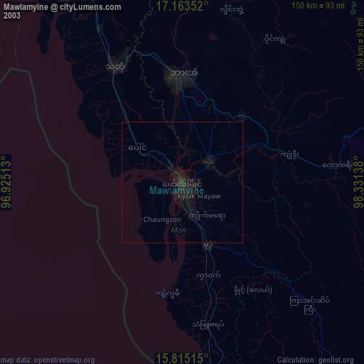
» NASA city lights 2003
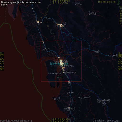
» Earth at Night: Flat Maps 2012, 2016