Călăraşi night lights from space
Night Light of Călăraşi from space (Moldova) Src. Average luminocity for 10x10km area is 0.4256% and for 50x50km: 0.0929%.
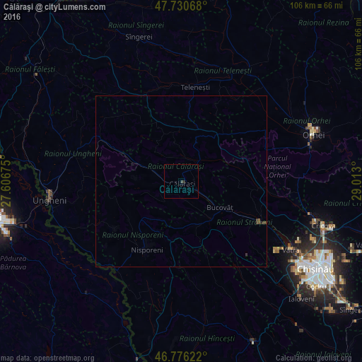
Analysis of Călăraşi night lights 2016
Square area 10x10 km:
 0%
0%90-99
0%80-89
0%70-79
0%60-69
0%50-59
0%40-49
0.6%30-39
0%20-29
0.6%10-19
0%0-9
98.81%Square area 50x50 km:
0%90-99
0%80-89
0%70-79
0%60-69
0%50-59
0.02%40-49
0.08%30-39
0.09%20-29
0.05%10-19
0%0-9
99.77%Clear (daylight) street map image can be seen on geolist.org.
Map coordinates:
47° 43' 50.4" North, 27° 36' 24.3" East
47° 15' 20.2" North, 28° 18' 35.5" East
46° 46' 34.4" North, 29° 0' 46.8" East
Some cities around Călăraşi sort by population:
• Ungheni
38.8 km =24.1 mi,  262°
262°
• Orhei
41.4 km =25.7 mi,  69°
69°
• Strășeni
25.8 km =16 mi,  119°
119°
• Sîngerei
44.2 km =27.5 mi,  343°
343°
• Nisporeni
22 km =13.7 mi,  208°
208°
• Mîndreşti
27.9 km =17.3 mi,  354°
354°
• Cricova
43.7 km =27.2 mi,  107°
107°
• Teleneşti
27.6 km =17.1 mi,  8°
8°
618454 (p: 14,066)
Sources (retrieved 2019-11-25):
» Earth at Night: Flat Maps 2012, 2016