Orhei night lights from space
Night Light of Orhei from space (Moldova) Src. Average luminocity for 10x10km area is 9.9792% and for 50x50km: 0.865%.
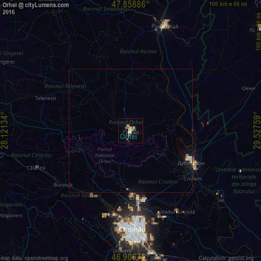

Analysis of Orhei night lights 2016
Square area 10x10 km:
 0%
0%90-99
2.38%80-89
1.64%70-79
1.34%60-69
0.74%50-59
2.83%40-49
0.6%30-39
1.64%20-29
1.34%10-19
0%0-9
87.5%Square area 50x50 km:
0.05%90-99
0.19%80-89
0.09%70-79
0.1%60-69
0.1%50-59
0.13%40-49
0.03%30-39
0.1%20-29
0.09%10-19
0.3%0-9
98.81%Clear (daylight) street map image can be seen on geolist.org.
Map coordinates:
47° 51' 31.9" North, 28° 7' 16.8" East
47° 23' 5.8" North, 28° 49' 28.1" East
46° 54' 24.2" North, 29° 31' 39.3" East
Some cities around Orhei sort by population:
• Dubăsari
29 km =18 mi,  117°
117°
• Strășeni
31.6 km =19.6 mi,  211°
211°
• Cricova
27.6 km =17.1 mi,  174°
174°
• Criuleni
31.7 km =19.7 mi,  127°
127°
• Ciorescu
28.8 km =17.9 mi, 170°
• Teleneşti
36.9 km =22.9 mi,  290°
290°
• Stăuceni
32.2 km =20 mi, 174°
• Cocieri
23.9 km =14.9 mi,  112°
112°
617638 (p: 24,918)
Sources (retrieved 2019-11-25):
» Earth at Night: Flat Maps 2012, 2016