Strășeni night lights from space
Night Light of Strășeni from space (Moldova) Src. Average luminocity for 10x10km area is 1.7202% and for 50x50km: 7.5154%.
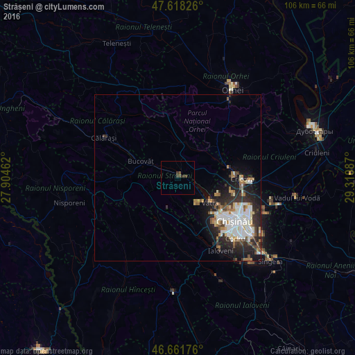
Analysis of Strășeni night lights 2016
Square area 10x10 km:
 0%
0%90-99
0%80-89
0%70-79
0%60-69
0%50-59
0.57%40-49
1.28%30-39
1.56%20-29
0.57%10-19
0%0-9
96.02%Square area 50x50 km:
1.56%90-99
1.82%80-89
0.73%70-79
0.5%60-69
0.91%50-59
0.73%40-49
0.74%30-39
1.13%20-29
2.87%10-19
3.52%0-9
85.47%Clear (daylight) street map image can be seen on geolist.org.
Map coordinates:
47° 37' 5.7" North, 27° 54' 16.6" East
47° 8' 31.8" North, 28° 36' 27.9" East
46° 39' 42.3" North, 29° 18' 39.1" East
Some cities around Strășeni sort by population:
• Chisinau
24.3 km =15.1 mi,  128°
128°
• Orhei
31.6 km =19.6 mi,  31°
31°
• Ialoveni
25.8 km =16 mi,  149°
149°
• Călăraşi
25.8 km =16 mi,  299°
299°
• Nisporeni
33.7 km =20.9 mi,  258°
258°
• Cricova
19.2 km =11.9 mi,  91°
91°
• Ciorescu
21.3 km =13.2 mi, 93°
• Stăuceni
20.3 km =12.6 mi,  104°
104°
617302 (p: 19,225)
Sources (retrieved 2019-11-25):
» Earth at Night: Flat Maps 2012, 2016