Nisporeni night lights from space
Night Light of Nisporeni from space (Moldova) Src. Average luminocity for 10x10km area is 0% and for 50x50km: 0.0207%.
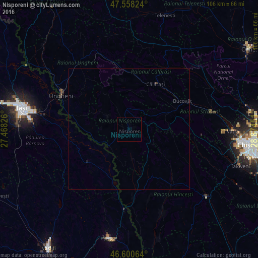
Analysis of Nisporeni night lights 2016
Square area 10x10 km:
 0%
0%90-99
0%80-89
0%70-79
0%60-69
0%50-59
0%40-49
0%30-39
0%20-29
0%10-19
0%0-9
100%Square area 50x50 km:
0%90-99
0%80-89
0%70-79
0%60-69
0%50-59
0%40-49
0.02%30-39
0%20-29
0.02%10-19
0.02%0-9
99.93%Clear (daylight) street map image can be seen on geolist.org.
Map coordinates:
47° 33' 29.7" North, 27° 28' 5.7" East
47° 4' 53.7" North, 28° 10' 17" East
46° 36' 2.3" North, 28° 52' 28.2" East
Some cities around Nisporeni sort by population:
• Ungheni
31.5 km =19.6 mi,  297°
297°
• Strășeni
33.7 km =20.9 mi,  78°
78°
• Călăraşi
22 km =13.7 mi,  28°
28°
• Tomeşti, RO
37.1 km =23.1 mi,  276°
276°
• Holboca, RO
36.5 km =22.7 mi, 282°
• Dancu
36.1 km =22.4 mi,  175°
175°
• Răducăneni, RO
23.2 km =14.4 mi,  230°
230°
• Duda, RO
38 km =23.6 mi,  195°
195°
617753 (p: 11,718)
Sources (retrieved 2019-11-25):
» Earth at Night: Flat Maps 2012, 2016