Monaco night lights from space
Night Light of Monaco from space (Monaco) Src. Average luminocity for 10x10km area is 37.4848% and for 50x50km: 16.5106%.
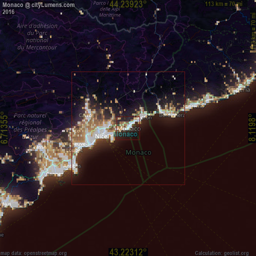
Analysis of Monaco night lights 2016
Square area 10x10 km:
 6.52%
6.52%90-99
7.42%80-89
3.18%70-79
3.48%60-69
6.06%50-59
3.94%40-49
2.73%30-39
2.58%20-29
25%10-19
25.76%0-9
13.33%Square area 50x50 km:
2.96%90-99
3.52%80-89
1.36%70-79
1.83%60-69
2.49%50-59
2.28%40-49
1.67%30-39
1.76%20-29
4.87%10-19
10.95%0-9
66.3%Clear (daylight) street map image can be seen on geolist.org.
Map coordinates:
44° 14' 21.2" North, 6° 42' 48.8" East
43° 43' 60" North, 7° 25' 0" East
43° 13' 23.2" North, 8° 7' 11.3" East
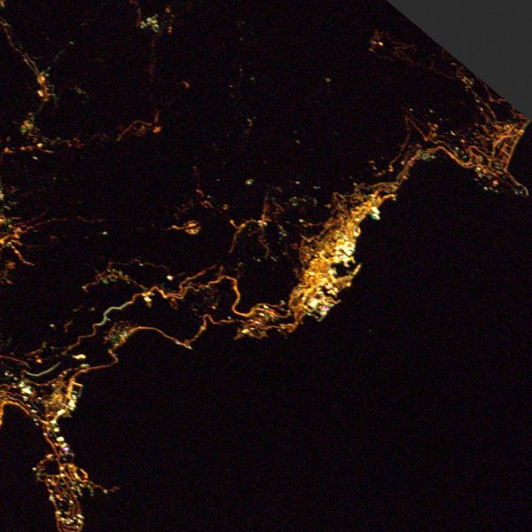
Fantastic image of Monaco from space taken by astronauts [src2], but I don't have information about it's orientation, scale or angle. If necessary, it was rotated manually, so North points approximately to upper direction. Click to zoom in:
Some cities around Monaco sort by population:
• Menton, FR
8.5 km =5.3 mi,  55°
55°
• Monte-Carlo
1.1 km =0.7 mi,  50°
50°
• Beausoleil, FR
1.2 km =0.7 mi,  23°
23°
• La Condamine
0.3 km =0.2 mi,  67°
67°
• Roquebrune-Cap-Martin, FR
6.3 km =3.9 mi, 56°
• La Trinité, FR
8.3 km =5.2 mi,  275°
275°
• Villefranche-sur-Mer, FR
9.1 km =5.7 mi,  248°
248°
• Contes, FR
12.1 km =7.5 mi,  317°
317°
2993458 (p: 32,965)
Sources (retrieved 2019-11-25):
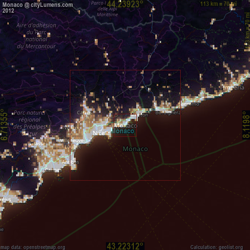
» Earth at Night: Flat Maps 2012, 2016
Src.2: Thomas Pesquet, Twitter/@Thom_astro, 2017-02-23