Palanga night lights from space
Night Light of Palanga (Klaipėda County) from space (Lithuania) Src. Average luminocity for 10x10km area is 7.5401% and for 50x50km: 2.7162%.
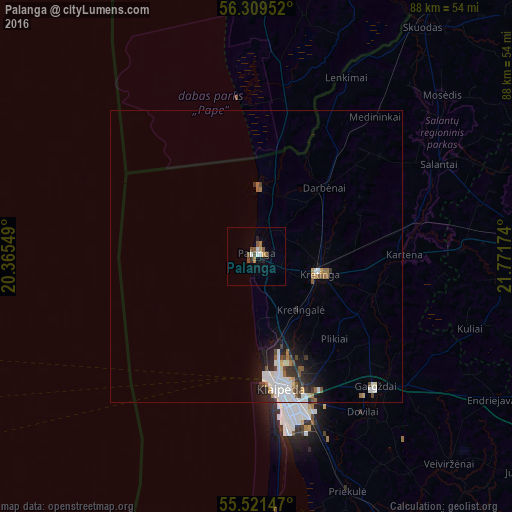
Analysis of Palanga night lights 2016
Square area 10x10 km:
 1%
1%90-99
1%80-89
0.75%70-79
0.63%60-69
0.63%50-59
2.63%40-49
1.38%30-39
0.38%20-29
1%10-19
0.75%0-9
89.85%Square area 50x50 km:
0.63%90-99
0.62%80-89
0.13%70-79
0.2%60-69
0.28%50-59
0.34%40-49
0.36%30-39
0.36%20-29
0.58%10-19
1.38%0-9
95.12%Clear (daylight) street map image can be seen on geolist.org.
Map coordinates:
56° 18' 34.3" North, 20° 21' 55.8" East
55° 55' 3" North, 21° 4' 7" East
55° 31' 17.3" North, 21° 46' 18.3" East
Some cities around Palanga sort by population:
• Klaipėda
23.8 km =14.8 mi,  169°
169°
• Liepāja, LV
65.4 km =40.6 mi,  356°
356°
• Plunge
48.3 km =30 mi,  90°
90°
• Kretinga
11.4 km =7.1 mi,  106°
106°
• Gargždai
30.8 km =19.1 mi,  138°
138°
• Skuodas
48.7 km =30.3 mi,  36°
36°
• Rucava, LV
27.9 km =17.3 mi,  11°
11°
• Nīca, LV
47.6 km =29.6 mi, 359°
596238 (p: 17,796)
Sources (retrieved 2019-11-25):
» Earth at Night: Flat Maps 2012, 2016