Liepāja night lights from space
Night Light of Liepāja from space (Latvia) Src. Average luminocity for 10x10km area is 26.1614% and for 50x50km: 1.3933%.
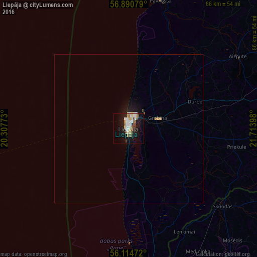
Analysis of Liepāja night lights 2016
Square area 10x10 km:
 5.34%
5.34%90-99
6.14%80-89
3.98%70-79
1.82%60-69
2.05%50-59
2.05%40-49
2.95%30-39
2.27%20-29
1.82%10-19
25.34%0-9
46.25%Square area 50x50 km:
0.24%90-99
0.28%80-89
0.19%70-79
0.09%60-69
0.15%50-59
0.12%40-49
0.14%30-39
0.09%20-29
0.11%10-19
1.56%0-9
97.02%Clear (daylight) street map image can be seen on geolist.org.
Map coordinates:
56° 53' 26.8" North, 20° 18' 27.8" East
56° 30' 17.1" North, 21° 0' 39.1" East
56° 6' 53" North, 21° 42' 50.3" East
Some cities around Liepāja sort by population:
• Skuodas, LT
41.3 km =25.7 mi,  129°
129°
• Karosta
5.2 km =3.2 mi,  1°
1°
• Aizpute
43.4 km =27 mi,  56°
56°
• Grobiņa
10.2 km =6.3 mi,  70°
70°
• Priekule
36.1 km =22.4 mi,  100°
100°
• Rucava
39.1 km =24.3 mi,  166°
166°
• Lieģi
21.6 km =13.4 mi, 66°
• Nīca
17.9 km =11.1 mi, 169°
457954 (p: 85,132)
Sources (retrieved 2019-11-25):
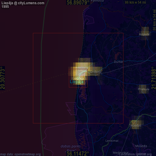
» NASA, Earths city lights 1995
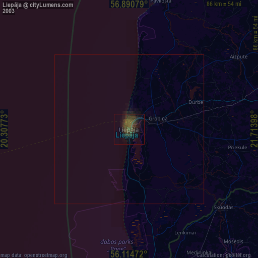
» NASA city lights 2003
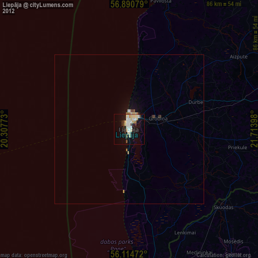
» Earth at Night: Flat Maps 2012, 2016