Polonnaruwa night lights from space
Night Light of Polonnaruwa (North Central) from space (Sri Lanka) Src. Average luminocity for 10x10km area is 5.4504% and for 50x50km: 0.3121%.
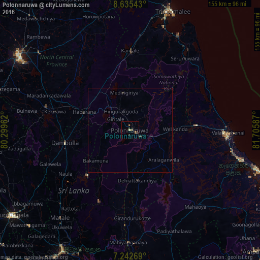
Analysis of Polonnaruwa night lights 2016
Square area 10x10 km:
 0%
0%90-99
0.21%80-89
0.62%70-79
0.62%60-69
1.86%50-59
0.83%40-49
0.83%30-39
3.31%20-29
1.03%10-19
1.03%0-9
89.67%Square area 50x50 km:
0%90-99
0.01%80-89
0.03%70-79
0.03%60-69
0.08%50-59
0.07%40-49
0.06%30-39
0.18%20-29
0.08%10-19
0.16%0-9
99.33%Clear (daylight) street map image can be seen on geolist.org.
Map coordinates:
8° 38' 7.5" North, 80° 17' 58.6" East
7° 56' 22.7" North, 81° 0' 9.9" East
7° 14' 33.7" North, 81° 42' 21.1" East
Some cities around Polonnaruwa sort by population:
• Kandy
82.8 km =51.4 mi,  209°
209°
• Trincomalee
75.2 km =46.7 mi,  19°
19°
• Batticaloa
80.1 km =49.8 mi,  108°
108°
• Dambulla
39.7 km =24.7 mi,  257°
257°
• Anuradhapura
77 km =47.8 mi,  302°
302°
• Matale
67 km =41.6 mi,  218°
218°
• Eravur Town
68.6 km =42.6 mi, 105°
• Vakarai
52.1 km =32.4 mi,  65°
65°
1229901 (p: 13,900)
Sources (retrieved 2019-11-25):
» Earth at Night: Flat Maps 2012, 2016