Eravur Town night lights from space
Night Light of Eravur Town (Eastern Province) from space (Sri Lanka) Src. Average luminocity for 10x10km area is 12.4194% and for 50x50km: 3.1779%.
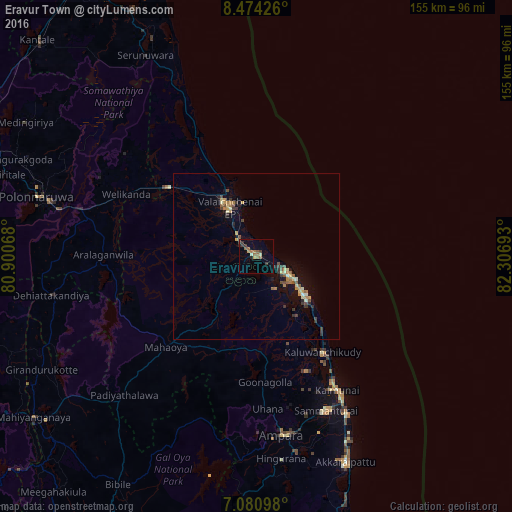
Analysis of Eravur Town night lights 2016
Square area 10x10 km:
 0%
0%90-99
1.45%80-89
0.21%70-79
1.65%60-69
5.17%50-59
2.48%40-49
1.24%30-39
3.1%20-29
1.45%10-19
0.83%0-9
82.44%Square area 50x50 km:
0%90-99
0.32%80-89
0.42%70-79
0.53%60-69
0.52%50-59
0.55%40-49
0.57%30-39
0.7%20-29
0.41%10-19
1.72%0-9
94.26%Clear (daylight) street map image can be seen on geolist.org.
Map coordinates:
8° 28' 27.3" North, 80° 54' 2.4" East
7° 46' 41.5" North, 81° 36' 13.7" East
7° 4' 51.5" North, 82° 18' 24.9" East
Some cities around Eravur Town sort by population:
• Trincomalee
98 km =60.9 mi,  335°
335°
• Kalmunai
48.3 km =30 mi,  148°
148°
• Batticaloa
12.3 km =7.6 mi,  127°
127°
• Dambulla
105.3 km =65.4 mi,  274°
274°
• Vakarai
43.7 km =27.2 mi,  334°
334°
• Ampara
54.1 km =33.6 mi,  170°
170°
• Polonnaruwa
68.6 km =42.6 mi,  285°
285°
• Monaragala
104.7 km =65.1 mi,  195°
195°
1246924 (p: 22,982)
Sources (retrieved 2019-11-25):
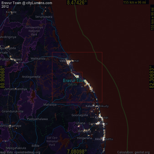
» Earth at Night: Flat Maps 2012, 2016