Ja Ela night lights from space
Night Light of Ja Ela (Western) from space (Sri Lanka) Src. Average luminocity for 10x10km area is 65.2208% and for 50x50km: 27.6144%.
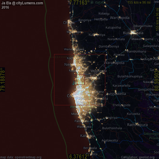
Analysis of Ja Ela night lights 2016
Square area 10x10 km:
 3.9%
3.9%90-99
13.64%80-89
11.47%70-79
13.85%60-69
20.35%50-59
15.58%40-49
7.79%30-39
2.81%20-29
10.39%10-19
0.22%0-9
0%Square area 50x50 km:
4.11%90-99
4.72%80-89
3.44%70-79
4.76%60-69
5.12%50-59
4.37%40-49
4.37%30-39
4.04%20-29
6.12%10-19
9.33%0-9
49.62%Clear (daylight) street map image can be seen on geolist.org.
Map coordinates:
7° 46' 17.9" North, 79° 11' 19.6" East
7° 4' 27.8" North, 79° 53' 30.8" East
6° 22' 34" North, 80° 35' 42.1" East
Some cities around Ja Ela sort by population:
• Katunayaka
10.6 km =6.6 mi,  357°
357°
• Hendala
9.3 km =5.8 mi,  186°
186°
• Welisara
5.3 km =3.3 mi,  168°
168°
• Kandana
2.9 km =1.8 mi,  176°
176°
• Wattala
9.5 km =5.9 mi, 180°
• Peliyagoda
11.8 km =7.3 mi, 184°
• Gampaha
11.2 km =7 mi,  81°
81°
• Minuwangoda
12.3 km =7.6 mi,  33°
33°
1242835 (p: 32,175)
Sources (retrieved 2019-11-25):
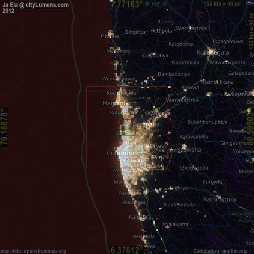
» Earth at Night: Flat Maps 2012, 2016