Katunayaka night lights from space
Night Light of Katunayaka (Western) from space (Sri Lanka) Src. Average luminocity for 10x10km area is 64.4827% and for 50x50km: 20.5511%.
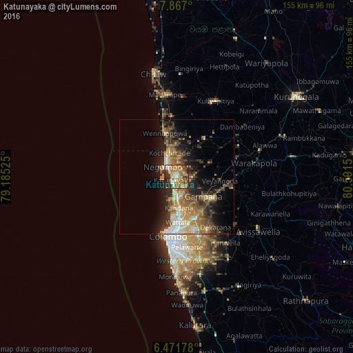
Analysis of Katunayaka night lights 2016
Square area 10x10 km:
 8.23%
8.23%90-99
9.31%80-89
10.39%70-79
18.18%60-69
15.8%50-59
10.17%40-49
8.01%30-39
9.09%20-29
10.82%10-19
0%0-9
0%Square area 50x50 km:
1.96%90-99
3.01%80-89
2.47%70-79
3.46%60-69
4.07%50-59
3.53%40-49
4.08%30-39
3.62%20-29
5.65%10-19
9.07%0-9
59.09%Clear (daylight) street map image can be seen on geolist.org.
Map coordinates:
7° 52' 1.2" North, 79° 11' 6.9" East
7° 10' 11.7" North, 79° 53' 18.1" East
6° 28' 18.4" North, 80° 35' 29.4" East
Some cities around Katunayaka sort by population:
• Negombo
7.2 km =4.5 mi,  306°
306°
• Hendala
19.9 km =12.4 mi,  181°
181°
• Welisara
15.8 km =9.8 mi,  174°
174°
• Kandana
13.6 km =8.5 mi, 177°
• Ja Ela
10.6 km =6.6 mi, 177°
• Wattala
20.1 km =12.5 mi, 178°
• Gampaha
14.5 km =9 mi,  127°
127°
• Minuwangoda
7.2 km =4.5 mi,  93°
93°
1240935 (p: 84,643)
Sources (retrieved 2019-11-25):
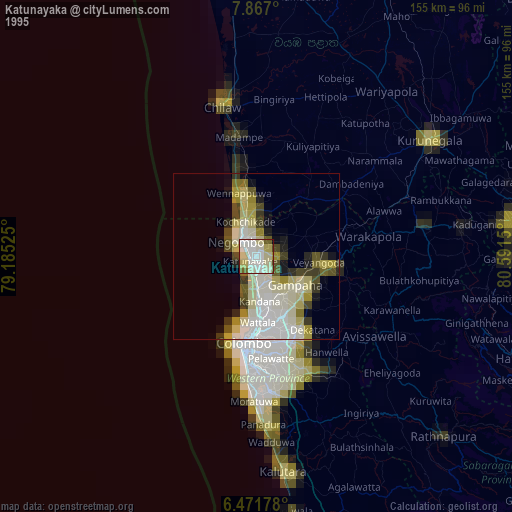
» NASA, Earths city lights 1995
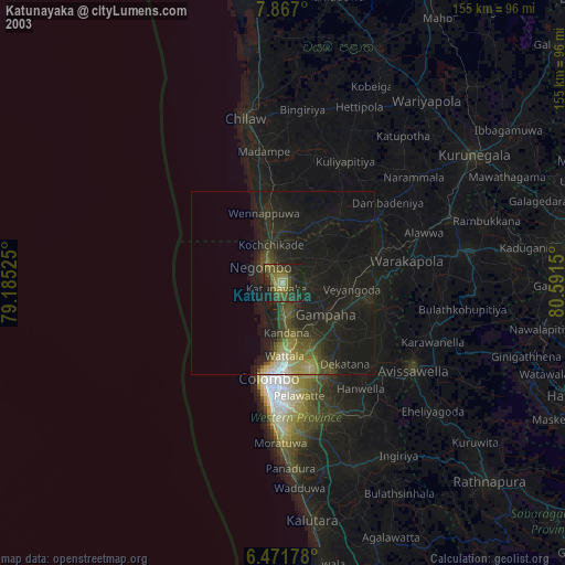
» NASA city lights 2003
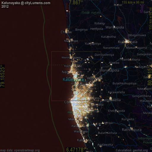
» Earth at Night: Flat Maps 2012, 2016