Kalmunai night lights from space
Night Light of Kalmunai (Eastern Province) from space (Sri Lanka) Src. Average luminocity for 10x10km area is 21.3398% and for 50x50km: 3.4392%.
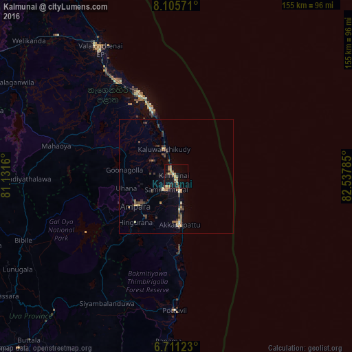
Analysis of Kalmunai night lights 2016
Square area 10x10 km:
 0%
0%90-99
1.52%80-89
4.11%70-79
4.98%60-69
6.28%50-59
1.08%40-49
1.95%30-39
2.6%20-29
3.68%10-19
21.65%0-9
52.16%Square area 50x50 km:
0.02%90-99
0.33%80-89
0.45%70-79
0.52%60-69
0.55%50-59
0.53%40-49
0.65%30-39
0.89%20-29
0.53%10-19
1.43%0-9
94.11%Clear (daylight) street map image can be seen on geolist.org.
Map coordinates:
8° 6' 20.6" North, 81° 7' 53.8" East
7° 24' 32.5" North, 81° 50' 5" East
6° 42' 40.4" North, 82° 32' 16.3" East
Some cities around Kalmunai sort by population:
• Batticaloa
37 km =23 mi,  334°
334°
• Badulla
98.1 km =61 mi,  240°
240°
• Eravur Town
48.3 km =30 mi, 328°
• Vakarai
91.9 km =57.1 mi, 331°
• Ampara
20.9 km =13 mi,  233°
233°
• Polonnaruwa
109 km =67.7 mi,  302°
302°
• Monaragala
80.3 km =49.9 mi,  221°
221°
• Wattegama
78.3 km =48.7 mi,  209°
209°
1242110 (p: 100,171)
Sources (retrieved 2019-11-25):
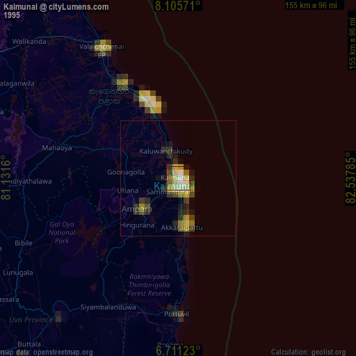
» NASA, Earths city lights 1995
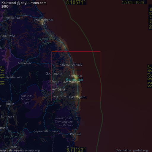
» NASA city lights 2003
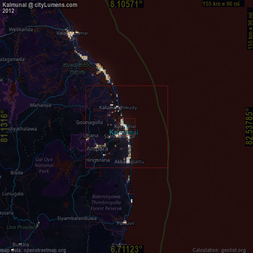
» Earth at Night: Flat Maps 2012, 2016