Petropavl night lights from space
Night Light of Petropavl (Soltüstik Qazaqstan) from space (Kazakhstan) Src. Average luminocity for 10x10km area is 59.6148% and for 50x50km: 3.2526%.
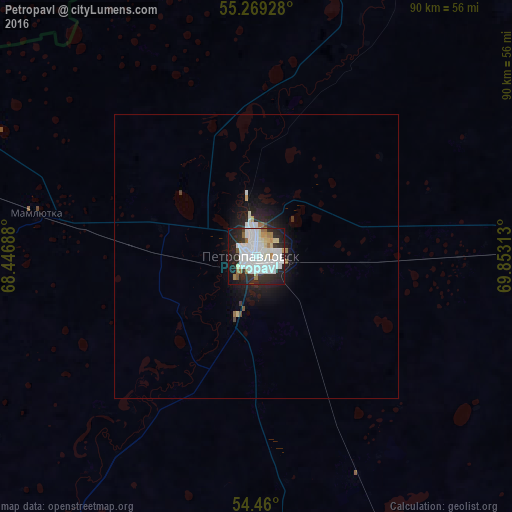
Analysis of Petropavl night lights 2016
Square area 10x10 km:
 22.13%
90-99
19.62%80-89
3.71%70-79
2.03%60-69
4.9%50-59
2.63%40-49
0.24%30-39
3.83%20-29
20.33%10-19
17.94%0-9
2.63%Square area 50x50 km:
0.98%90-99
0.88%80-89
0.18%70-79
0.11%60-69
0.26%50-59
0.16%40-49
0.08%30-39
0.21%20-29
1.21%10-19
2.38%0-9
93.54%Clear (daylight) street map image can be seen on geolist.org.
Map coordinates:
55° 16' 9.4" North, 68° 26' 48.8" East
54° 52' 0" North, 69° 9' 0" East
54° 27' 36" North, 69° 51' 11.3" East
Some cities around Petropavl sort by population:
• Ishim, RU
140.2 km =87.1 mi,  8°
8°
• Taiynsha
120.1 km =74.6 mi,  160°
160°
• Petukhovo, RU
82.8 km =51.4 mi,  285°
285°
• Bulayevo
82.7 km =51.4 mi,  86°
86°
• Makushino, RU
127.3 km =79.1 mi, 287°
• Kazanskoye, RU
86.7 km =53.9 mi,  3°
3°
• Smirnovo
43 km =26.7 mi, 155°
• Bishkul
10.4 km =6.5 mi,  198°
198°
1520172 (p: 200,920)
Sources (retrieved 2019-11-25):
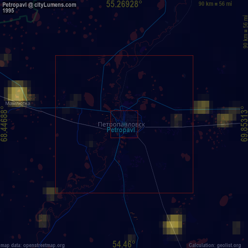
» NASA, Earths city lights 1995
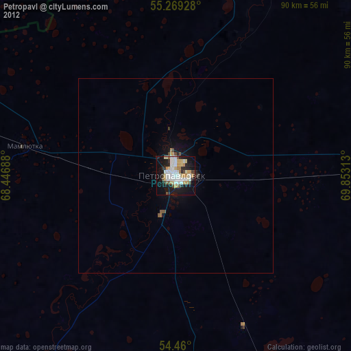
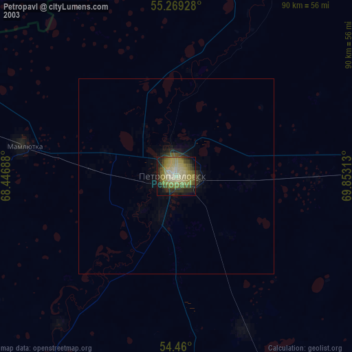
» NASA city lights 2003
» Earth at Night: Flat Maps 2012, 2016