Az Zawr night lights from space
Night Light of Az Zawr (Al Asimah) from space (Kuwait) Src. Average luminocity for 10x10km area is 1.8106% and for 50x50km: 11.2472%.
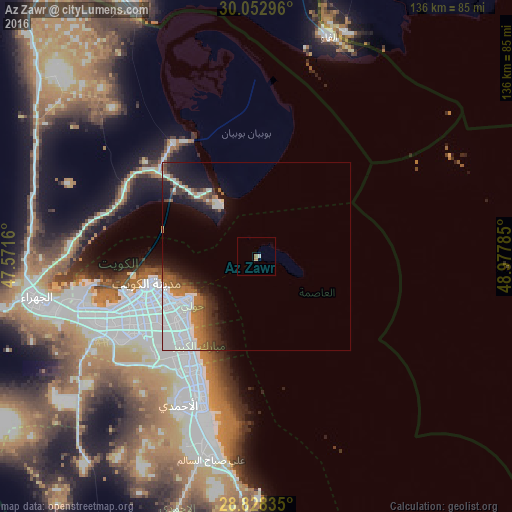
Analysis of Az Zawr night lights 2016
Square area 10x10 km:
 0%
0%90-99
0.76%80-89
0%70-79
0%60-69
1.52%50-59
0%40-49
0%30-39
0%20-29
0%10-19
0%0-9
97.73%Square area 50x50 km:
4.79%90-99
1.45%80-89
0.06%70-79
0.51%60-69
1.87%50-59
1.39%40-49
1.1%30-39
1.64%20-29
1.88%10-19
5.25%0-9
80.06%Clear (daylight) street map image can be seen on geolist.org.
Map coordinates:
30° 3' 10.7" North, 47° 34' 17.8" East
29° 26' 33" North, 48° 16' 29" East
28° 49' 42.1" North, 48° 58' 40.3" East
Some cities around Az Zawr sort by population:
• Ḩawallī
26.8 km =16.7 mi,  242°
242°
• As Sālimīyah
22.7 km =14.1 mi, 237°
• Şabāḩ as Sālim
29.5 km =18.3 mi,  225°
225°
• Kuwait City
29.8 km =18.5 mi,  254°
254°
• Ar Rumaythīyah
24.3 km =15.1 mi, 233°
• Salwá
25 km =15.5 mi, 229°
• Bayān
26.8 km =16.7 mi, 234°
• Ad Dasmah
27.8 km =17.3 mi, 251°
285673 (p: 5,750)
Sources (retrieved 2019-11-25):
» Earth at Night: Flat Maps 2012, 2016