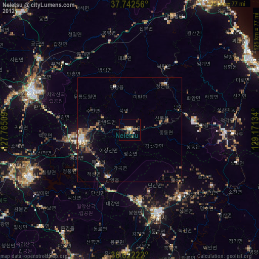
Neietsu night lights from space
Night Light of Neietsu (Gangwon-do) from space (South Korea) Src. Average luminocity for 10x10km area is 16.0229% and for 50x50km: 4.6898%.
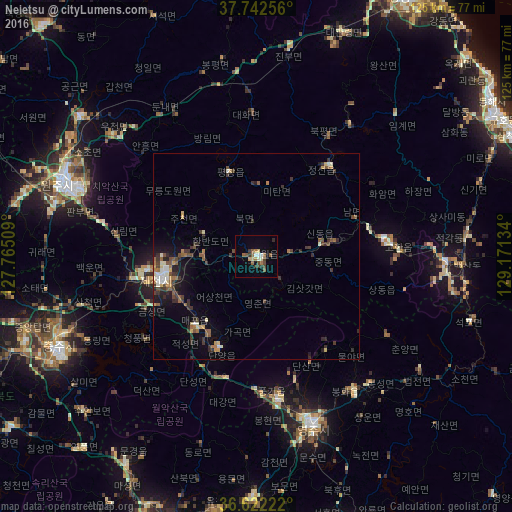
Analysis of Neietsu night lights 2016
Square area 10x10 km:
 0.88%
0.88%90-99
2.65%80-89
1.76%70-79
0.35%60-69
3%50-59
4.76%40-49
3%30-39
3%20-29
1.06%10-19
1.59%0-9
77.95%Square area 50x50 km:
0.27%90-99
0.74%80-89
0.38%70-79
0.36%60-69
0.79%50-59
0.91%40-49
0.71%30-39
1.5%20-29
0.99%10-19
2.08%0-9
91.28%Clear (daylight) street map image can be seen on geolist.org.
Map coordinates:
37° 44' 33.2" North, 127° 45' 54.3" East
37° 11' 4.1" North, 128° 28' 5.6" East
36° 37' 20" North, 129° 10' 16.8" East
Some cities around Neietsu sort by population:
• Wŏnju
49.9 km =31 mi,  291°
291°
• Andong
72.4 km =45 mi,  161°
161°
• Tonghae
69.2 km =43 mi,  54°
54°
• Eisen
42.8 km =26.6 mi, 160°
• Mungyeong
69.8 km =43.4 mi,  200°
200°
• T’aebaek
46.1 km =28.6 mi,  91°
91°
• Santyoku
68.3 km =42.4 mi,  65°
65°
• Pyeongchang
21.7 km =13.5 mi,  342°
342°
1832257 (p: 25,413)
Sources (retrieved 2019-11-25):
» Earth at Night: Flat Maps 2012, 2016