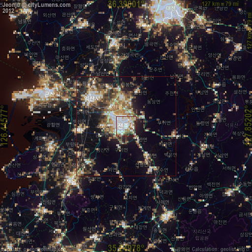
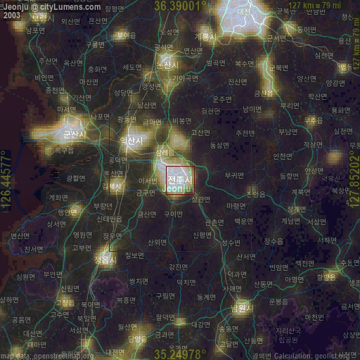
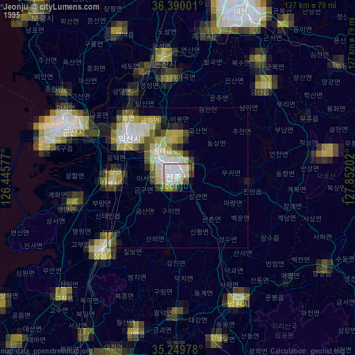
Jeonju night lights from space
Night Light of Jeonju (Jeollabuk-do) from space (South Korea) Src. Average luminocity for 10x10km area is 81.035% and for 50x50km: 22.0594%.
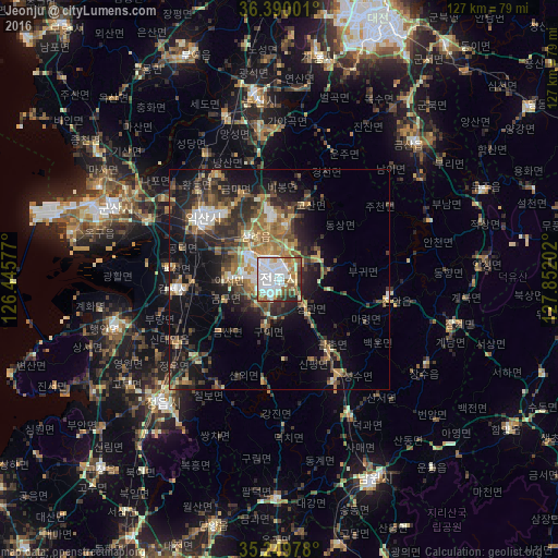
Analysis of Jeonju night lights 2016
Square area 10x10 km:
 33.57%
90-99
22.38%80-89
9.27%70-79
3.5%60-69
9.97%50-59
7.69%40-49
4.72%30-39
4.55%20-29
4.37%10-19
0%0-9
0%Square area 50x50 km:
2.72%90-99
3.16%80-89
2.08%70-79
2.38%60-69
4.13%50-59
4.01%40-49
3.5%30-39
5.18%20-29
7.26%10-19
11.79%0-9
53.81%Clear (daylight) street map image can be seen on geolist.org.
Map coordinates:
36° 23' 24" North, 126° 26' 44.8" East
35° 49' 19" North, 127° 8' 56" East
35° 14' 59.2" North, 127° 51' 7.3" East
Some cities around Jeonju sort by population:
• Iksan
22.2 km =13.8 mi,  307°
307°
• Jeongeup
32.4 km =20.1 mi,  220°
220°
• Wanju
2.6 km =1.6 mi,  357°
357°
• Kimje
23.6 km =14.7 mi,  264°
264°
• Imsil
26 km =16.2 mi,  153°
153°
• Jinan-gun
25.1 km =15.6 mi,  97°
97°
• Changsu
38.3 km =23.8 mi,  120°
120°
• Yŏnmu
34.5 km =21.4 mi,  352°
352°
1845457 (p: 711,424)
Sources (retrieved 2019-11-25):
» NASA, Earths city lights 1995
» NASA city lights 2003
» Earth at Night: Flat Maps 2012, 2016