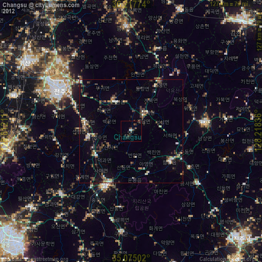
Changsu night lights from space
Night Light of Changsu (Jeollabuk-do) from space (South Korea) Src. Average luminocity for 10x10km area is 4.766% and for 50x50km: 5.5065%.
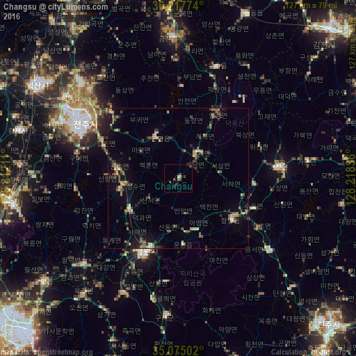
Analysis of Changsu night lights 2016
Square area 10x10 km:
 0%
0%90-99
0.51%80-89
0.84%70-79
0%60-69
0%50-59
1.68%40-49
2.36%30-39
0.67%20-29
1.85%10-19
0.84%0-9
91.25%Square area 50x50 km:
0.08%90-99
0.62%80-89
0.49%70-79
0.76%60-69
0.68%50-59
1.34%40-49
0.95%30-39
1.11%20-29
1.54%10-19
2.51%0-9
89.92%Clear (daylight) street map image can be seen on geolist.org.
Map coordinates:
36° 13' 3.9" North, 126° 48' 43.6" East
35° 38' 54.3" North, 127° 30' 54.8" East
35° 4' 30.1" North, 128° 13' 6.1" East
Some cities around Changsu sort by population:
• Jeonju
38.3 km =23.8 mi,  300°
300°
• Jeongeup
54.3 km =33.7 mi,  264°
264°
• Wanju
39.7 km =24.7 mi, 303°
• Nangen
29 km =18 mi,  203°
203°
• Imsil
21.7 km =13.5 mi, 259°
• Jinan-gun
17.9 km =11.1 mi,  332°
332°
• Kurye
49 km =30.4 mi,  185°
185°
• Kinzan
50.6 km =31.4 mi,  357°
357°
1846355 (p: 26,463)
Sources (retrieved 2019-11-25):
» Earth at Night: Flat Maps 2012, 2016