Jeju City night lights from space
Night Light of Jeju City (Jeju-do) from space (South Korea) Src. Average luminocity for 10x10km area is 63.7875% and for 50x50km: 13.8108%.
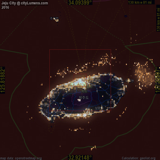
Analysis of Jeju City night lights 2016
Square area 10x10 km:
 14.65%
90-99
20.15%80-89
5.86%70-79
8.97%60-69
9.52%50-59
5.68%40-49
0.92%30-39
3.66%20-29
26.37%10-19
4.21%0-9
0%Square area 50x50 km:
0.69%90-99
2.32%80-89
1.51%70-79
1.65%60-69
2.12%50-59
1.88%40-49
1.91%30-39
2.38%20-29
5.19%10-19
11.15%0-9
69.2%Clear (daylight) street map image can be seen on geolist.org.
Map coordinates:
34° 5' 38.4" North, 125° 49' 7.8" East
33° 30' 35" North, 126° 31' 19" East
32° 55' 17.3" North, 127° 13' 30.3" East
Some cities around Jeju City sort by population:
• Mokpo
145.4 km =90.3 mi,  355°
355°
• Seogwipo
28.7 km =17.8 mi,  172°
172°
• Muan
164.7 km =102.3 mi, 358°
• Yeongam
144.4 km =89.7 mi,  6°
6°
• Sinan
151.2 km =94 mi,  345°
345°
• Haenam
118.2 km =73.4 mi,  3°
3°
• Gaigeturi
19.5 km =12.1 mi,  255°
255°
• Beolgyo
166.9 km =103.7 mi,  26°
26°
1846266 (p: 408,364)
Sources (retrieved 2019-11-25):
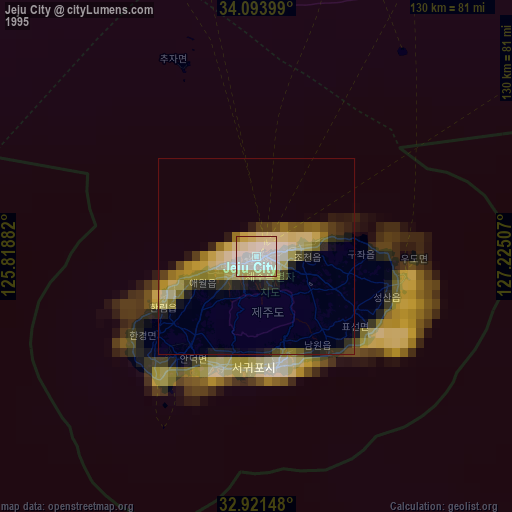
» NASA, Earths city lights 1995
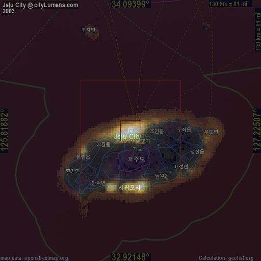
» NASA city lights 2003
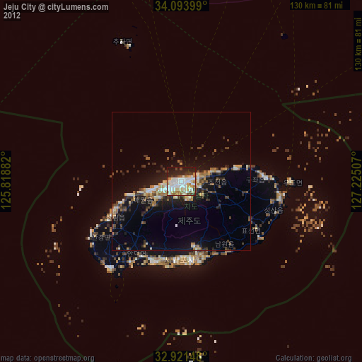
» Earth at Night: Flat Maps 2012, 2016