Gunsan night lights from space
Night Light of Gunsan (Jeollabuk-do) from space (South Korea) Src. Average luminocity for 10x10km area is 70.2656% and for 50x50km: 16.7176%.
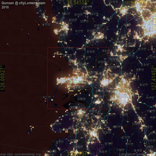
Analysis of Gunsan night lights 2016
Square area 10x10 km:
 14.65%
90-99
16.85%80-89
6.41%70-79
9.52%60-69
13.92%50-59
19.6%40-49
7.14%30-39
10.62%20-29
1.28%10-19
0%0-9
0%Square area 50x50 km:
1.76%90-99
2.41%80-89
1.23%70-79
1.85%60-69
2.3%50-59
3.39%40-49
2.44%30-39
3.97%20-29
5.98%10-19
12.24%0-9
62.43%Clear (daylight) street map image can be seen on geolist.org.
Map coordinates:
36° 32' 44" North, 126° 0' 29.8" East
35° 58' 43" North, 126° 42' 41" East
35° 24' 27.3" North, 127° 24' 52.3" East
Some cities around Gunsan sort by population:
• Iksan
22.2 km =13.8 mi,  100°
100°
• Wanju
42 km =26.1 mi,  110°
110°
• Boryeong
42.5 km =26.4 mi,  346°
346°
• Kimje
25.4 km =15.8 mi,  140°
140°
• Nonsan
41.9 km =26 mi,  53°
53°
• Buyeo
37.4 km =23.2 mi,  28°
28°
• Yŏnmu
38.8 km =24.1 mi,  64°
64°
• Puan
27.9 km =17.3 mi,  176°
176°
1842025 (p: 243,406)
Sources (retrieved 2019-11-25):
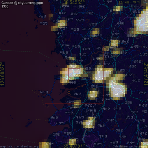
» NASA, Earths city lights 1995
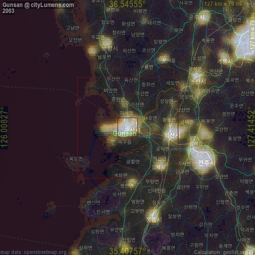
» NASA city lights 2003
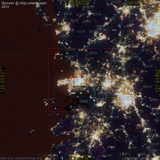
» Earth at Night: Flat Maps 2012, 2016