Osh night lights from space
Night Light of Osh from space (Kyrgyzstan) Src. Average luminocity for 10x10km area is 74.619% and for 50x50km: 10.4876%.
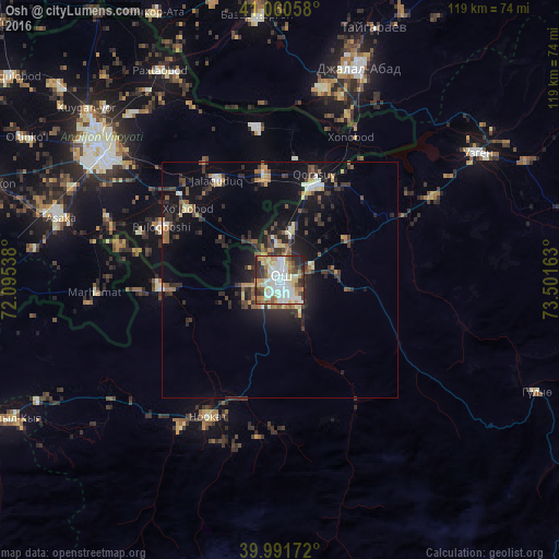
Analysis of Osh night lights 2016
Square area 10x10 km:
 20.92%
90-99
23.47%80-89
10.37%70-79
7.65%60-69
10.2%50-59
4.42%40-49
6.46%30-39
7.48%20-29
8.84%10-19
0.17%0-9
0%Square area 50x50 km:
1.17%90-99
1.6%80-89
1.12%70-79
0.94%60-69
1.29%50-59
1.48%40-49
1.27%30-39
2.65%20-29
3.68%10-19
7.66%0-9
77.15%Clear (daylight) street map image can be seen on geolist.org.
Map coordinates:
41° 3' 38.1" North, 72° 5' 43.4" East
40° 31' 41.8" North, 72° 47' 54.6" East
39° 59' 30.2" North, 73° 30' 5.9" East
Some cities around Osh sort by population:
• Andijon, UZ
47.6 km =29.6 mi,  306°
306°
• Jalal-Abad
48.1 km =29.9 mi,  20°
20°
• Asaka, UZ
48.9 km =30.4 mi,  284°
284°
• Qo‘rg‘ontepa, UZ
22.9 km =14.2 mi,  352°
352°
• Kara Suu
20.4 km =12.7 mi, 16°
• Xo‘jaobod, UZ
25.5 km =15.8 mi, 307°
• Marhamat, UZ
41.3 km =25.7 mi,  262°
262°
• Nookat
32.9 km =20.4 mi,  207°
207°
1527534 (p: 200,000)
Sources (retrieved 2019-11-25):
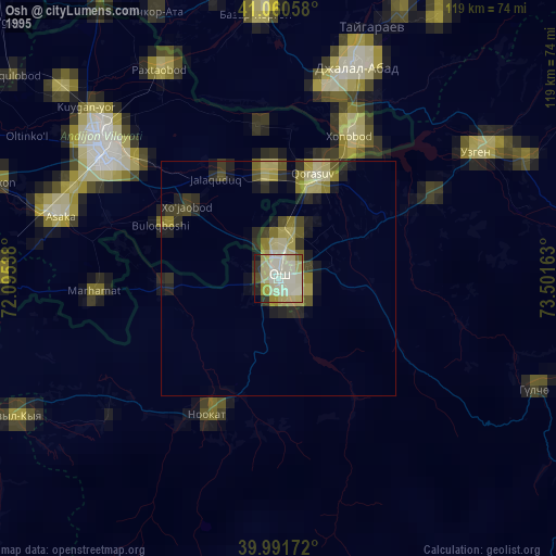
» NASA, Earths city lights 1995
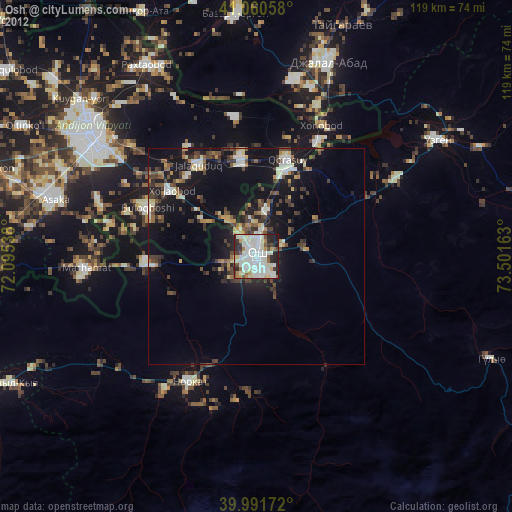
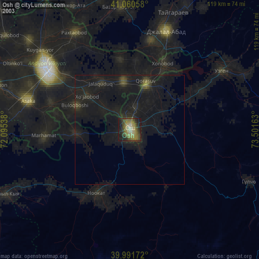
» NASA city lights 2003
» Earth at Night: Flat Maps 2012, 2016