Nookat night lights from space
Night Light of Nookat (Osh) from space (Kyrgyzstan) Src. Average luminocity for 10x10km area is 22.1461% and for 50x50km: 2.9293%.
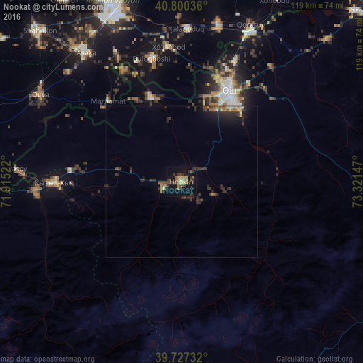
Analysis of Nookat night lights 2016
Square area 10x10 km:
 0%
0%90-99
1.14%80-89
3.08%70-79
2.27%60-69
3.9%50-59
3.73%40-49
4.71%30-39
8.77%20-29
5.52%10-19
21.59%0-9
45.29%Square area 50x50 km:
0.1%90-99
0.2%80-89
0.25%70-79
0.3%60-69
0.34%50-59
0.54%40-49
0.45%30-39
1.17%20-29
1.25%10-19
2.23%0-9
93.16%Clear (daylight) street map image can be seen on geolist.org.
Map coordinates:
40° 48' 1.3" North, 71° 54' 54.8" East
40° 15' 57.5" North, 72° 37' 6" East
39° 43' 38.4" North, 73° 19' 17.3" East
Some cities around Nookat sort by population:
• Osh
32.9 km =20.4 mi,  27°
27°
• Asaka, UZ
52.7 km =32.7 mi,  322°
322°
• Kyzyl-Kyya
41.6 km =25.8 mi,  268°
268°
• Iradan
44 km =27.3 mi, 270°
• Qo‘rg‘ontepa, UZ
53.2 km =33.1 mi,  13°
13°
• Kara Suu
53.1 km =33 mi,  23°
23°
• Xo‘jaobod, UZ
45.1 km =28 mi,  353°
353°
• Marhamat, UZ
35.1 km =21.8 mi,  312°
312°
1528339 (p: 14,371)
Sources (retrieved 2019-11-25):
» Earth at Night: Flat Maps 2012, 2016