Karakol night lights from space
Night Light of Karakol (Issyk-Kul) from space (Kyrgyzstan) Src. Average luminocity for 10x10km area is 8.319% and for 50x50km: 0.3567%.
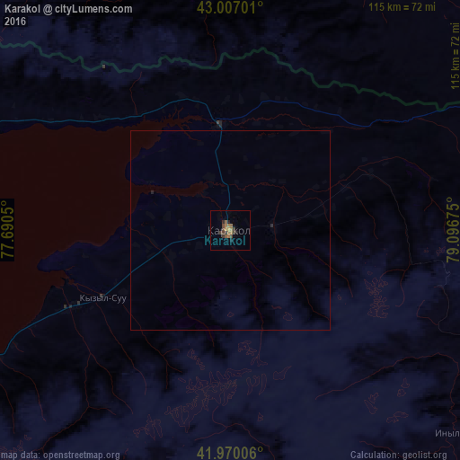
Analysis of Karakol night lights 2016
Square area 10x10 km:
 0%
0%90-99
0%80-89
0.16%70-79
1.11%60-69
3.65%50-59
2.06%40-49
2.54%30-39
3.02%20-29
1.27%10-19
1.43%0-9
84.76%Square area 50x50 km:
0%90-99
0%80-89
0.01%70-79
0.04%60-69
0.15%50-59
0.08%40-49
0.1%30-39
0.12%20-29
0.1%10-19
0.06%0-9
99.33%Clear (daylight) street map image can be seen on geolist.org.
Map coordinates:
43° 0' 25.2" North, 77° 41' 25.8" East
42° 29' 26.4" North, 78° 23' 37" East
41° 58' 12.2" North, 79° 5' 48.3" East
Some cities around Karakol sort by population:
• Talghar, KZ
130.3 km =81 mi,  313°
313°
• Esik, KZ
122.9 km =76.4 mi,  321°
321°
• Cholpon-Ata
108.8 km =67.6 mi,  279°
279°
• Kyzyl-Suu
35.8 km =22.2 mi,  242°
242°
• Tyup
26.4 km =16.4 mi,  354°
354°
• Turgen, KZ
120.3 km =74.8 mi,  327°
327°
• Ak-Suu
11 km =6.8 mi,  84°
84°
• Kegen, KZ
89.7 km =55.7 mi,  48°
48°
1528121 (p: 70,171)
Sources (retrieved 2019-11-25):
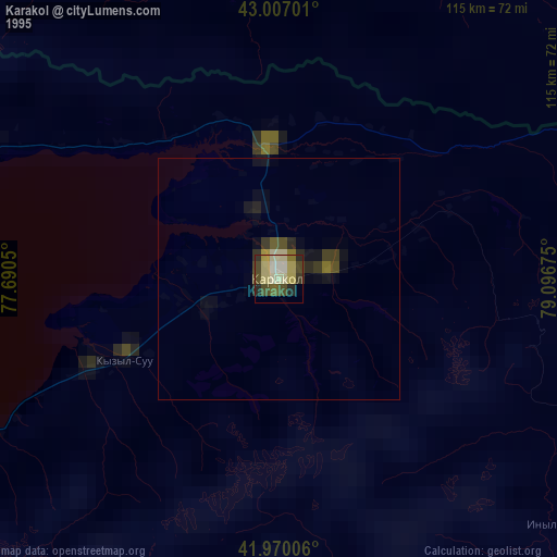
» NASA, Earths city lights 1995
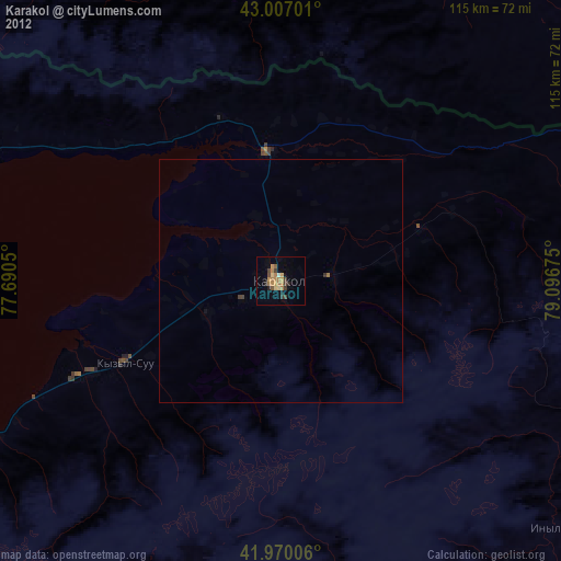
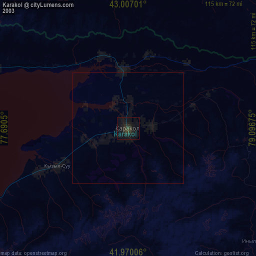
» NASA city lights 2003
» Earth at Night: Flat Maps 2012, 2016