Kwale night lights from space
Night Light of Kwale from space (Kenya) Src. Average luminocity for 10x10km area is 1.2749% and for 50x50km: 7.2001%.
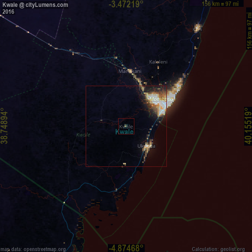
Analysis of Kwale night lights 2016
Square area 10x10 km:
100  0%
0%
90-99 0%
80-89 0%
70-79 0%
60-69 0.43%
50-59 0.43%
40-49 0%
30-39 0.87%
20-29 0.87%
10-19 0.87%
0-9 96.54%
0%90-99
0%80-89
0%70-79
0%60-69
0.43%50-59
0.43%40-49
0%30-39
0.87%20-29
0.87%10-19
0.87%0-9
96.54%Square area 50x50 km:
100 1.24%
90-99 1.12%
80-89 0.89%
70-79 0.99%
60-69 0.74%
50-59 0.88%
40-49 1.38%
30-39 1.11%
20-29 1.68%
10-19 3.89%
0-9 86.07%
1.24%90-99
1.12%80-89
0.89%70-79
0.99%60-69
0.74%50-59
0.88%40-49
1.38%30-39
1.11%20-29
1.68%10-19
3.89%0-9
86.07%Clear (daylight) street map image can be seen on geolist.org.
Map coordinates:
3° 28' 19.9" South, 38° 44' 56.2" East
4° 10' 25.5" South, 39° 27' 7.4" East
4° 52' 28.8" South, 40° 9' 18.7" East
Some cities around Kwale sort by population:
• Mombasa
26.9 km =16.7 mi,  60°
60°
• Kilifi
74.8 km =46.5 mi,  36°
36°
• Sawa Sawa
33.3 km =20.7 mi,  173°
173°
• Mariakani
34.7 km =21.6 mi,  4°
4°
• Takaungu
70.6 km =43.9 mi, 39°
• Konde, TZ
92.4 km =57.4 mi,  159°
159°
• Kinango
15.7 km =9.8 mi,  284°
284°
• Gazi
28.5 km =17.7 mi, 167°
190108 (p: 4,883)
Sources (retrieved 2019-11-25):
» Earth at Night: Flat Maps 2012, 2016