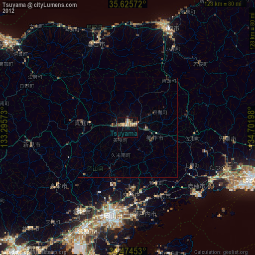
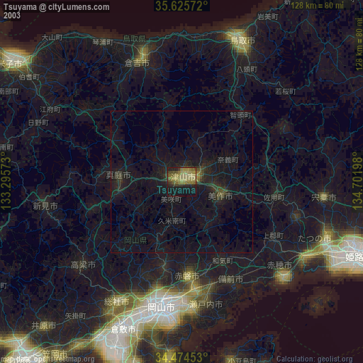
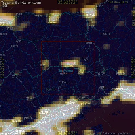
Tsuyama night lights from space
Night Light of Tsuyama (Okayama) from space (Japan) Src. Average luminocity for 10x10km area is 16.2395% and for 50x50km: 1.225%.

Analysis of Tsuyama night lights 2016
Square area 10x10 km:
 0.35%
0.35%90-99
0.35%80-89
3.67%70-79
1.92%60-69
2.97%50-59
6.12%40-49
2.97%30-39
1.75%20-29
1.57%10-19
2.27%0-9
76.05%Square area 50x50 km:
0.01%90-99
0.02%80-89
0.17%70-79
0.09%60-69
0.18%50-59
0.51%40-49
0.19%30-39
0.34%20-29
0.32%10-19
0.22%0-9
97.94%Clear (daylight) street map image can be seen on geolist.org.
Map coordinates:
35° 37' 32.6" North, 133° 17' 44.6" East
35° 3' 7.7" North, 133° 59' 55.9" East
34° 28' 28.3" North, 134° 42' 7.1" East
Some cities around Tsuyama sort by population:
• Okayama
45.1 km =28 mi,  187°
187°
• Sōja
47.6 km =29.6 mi,  208°
208°
• Kariya
48.7 km =30.3 mi,  133°
133°
• Kurayoshi
45.5 km =28.3 mi,  338°
338°
• Aioi
50.9 km =31.6 mi,  122°
122°
• Yamazakichō-nakabirose
50.5 km =31.4 mi,  96°
96°
• Takahashi
45.9 km =28.5 mi,  229°
229°
• Niimi
49.1 km =30.5 mi,  261°
261°
1849519 (p: 89,717)
Sources (retrieved 2019-11-25):
» NASA, Earths city lights 1995
» NASA city lights 2003
» Earth at Night: Flat Maps 2012, 2016