Kariya night lights from space
Night Light of Kariya (Hyōgo) from space (Japan) Src. Average luminocity for 10x10km area is 18.8498% and for 50x50km: 6.5537%.
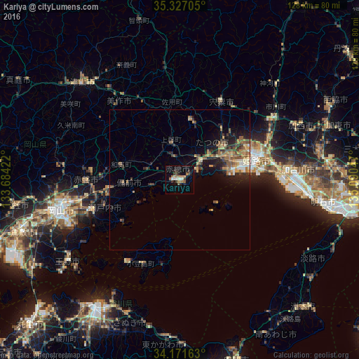
Analysis of Kariya night lights 2016
Square area 10x10 km:
 1.65%
1.65%90-99
2.56%80-89
1.65%70-79
0.18%60-69
6.59%50-59
2.2%40-49
2.38%30-39
2.93%20-29
3.48%10-19
10.62%0-9
65.75%Square area 50x50 km:
0.31%90-99
0.57%80-89
0.84%70-79
0.89%60-69
1.42%50-59
1.34%40-49
1.39%30-39
1.01%20-29
1.88%10-19
3.99%0-9
86.36%Clear (daylight) street map image can be seen on geolist.org.
Map coordinates:
35° 19' 37.4" North, 133° 41' 3.2" East
34° 45' 4.9" North, 134° 23' 14.4" East
34° 10' 17.9" North, 135° 5' 25.7" East
Some cities around Kariya sort by population:
• Himeji
29.5 km =18.3 mi,  75°
75°
• Kakogawachō-honmachi
40.4 km =25.1 mi,  87°
87°
• Tatsunochō-tominaga
19.6 km =12.2 mi,  50°
50°
• Aioi
9.4 km =5.8 mi, 51°
• Yamazakichō-nakabirose
31.4 km =19.5 mi,  28°
28°
• Shirahamachō-usazakiminami
30.3 km =18.8 mi, 83°
• Tonoshō
36.1 km =22.4 mi,  213°
213°
• Yonedacho Sendo
40.1 km =24.9 mi, 86°
1865412 (p: 52,015)
Sources (retrieved 2019-11-25):
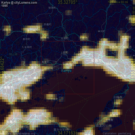
» NASA, Earths city lights 1995
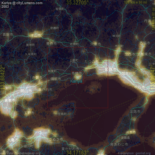
» NASA city lights 2003
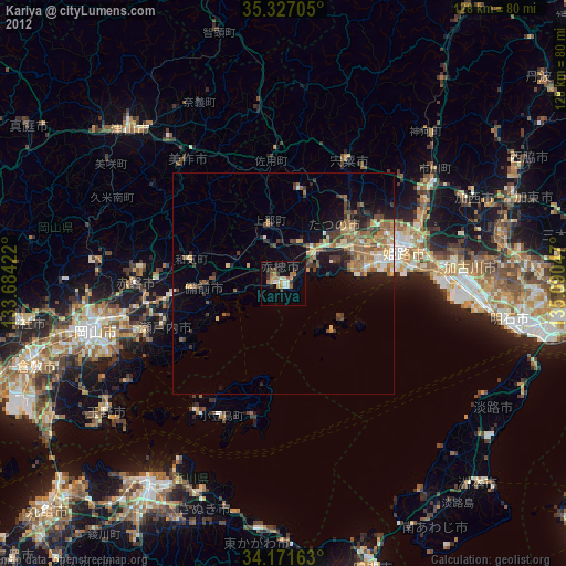
» Earth at Night: Flat Maps 2012, 2016