Sōja night lights from space
Night Light of Sōja (Okayama) from space (Japan) Src. Average luminocity for 10x10km area is 19.7675% and for 50x50km: 16.4114%.
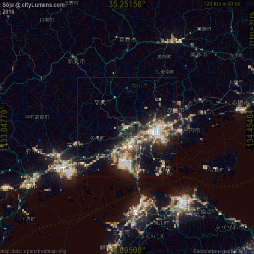
Analysis of Sōja night lights 2016
Square area 10x10 km:
 0.52%
0.52%90-99
0.52%80-89
3.15%70-79
0.87%60-69
3.85%50-59
3.32%40-49
2.97%30-39
2.45%20-29
13.81%10-19
24.65%0-9
43.88%Square area 50x50 km:
1.68%90-99
2.15%80-89
2.36%70-79
2.1%60-69
2.36%50-59
3.09%40-49
3.21%30-39
2.66%20-29
5.46%10-19
8.94%0-9
65.98%Clear (daylight) street map image can be seen on geolist.org.
Map coordinates:
35° 15' 5.6" North, 133° 2' 52" East
34° 40' 31.2" North, 133° 45' 3.3" East
34° 5' 42.3" North, 134° 27' 14.5" East
Some cities around Sōja sort by population:
• Okayama
16.9 km =10.5 mi,  99°
99°
• Kurashiki
10.3 km =6.4 mi,  171°
171°
• Tamano
25 km =15.5 mi,  134°
134°
• Kasaoka
29.4 km =18.3 mi,  230°
230°
• Kannabechō-yahiro
33.1 km =20.6 mi,  246°
246°
• Ibara
27.3 km =17 mi, 252°
• Takahashi
17.2 km =10.7 mi,  314°
314°
• Kamogatachō-kamogata
21.3 km =13.2 mi,  223°
223°
1851606 (p: 57,469)
Sources (retrieved 2019-11-25):
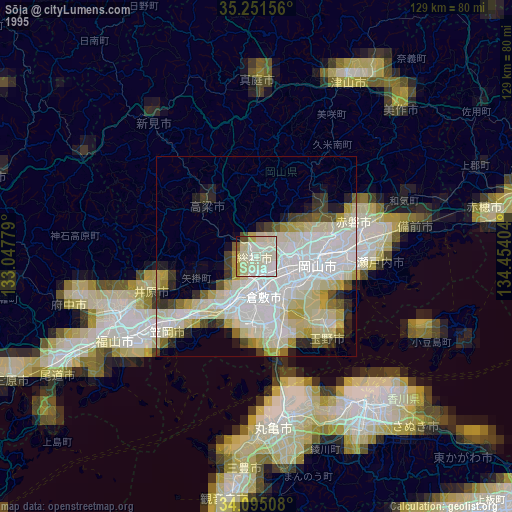
» NASA, Earths city lights 1995
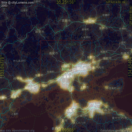
» NASA city lights 2003
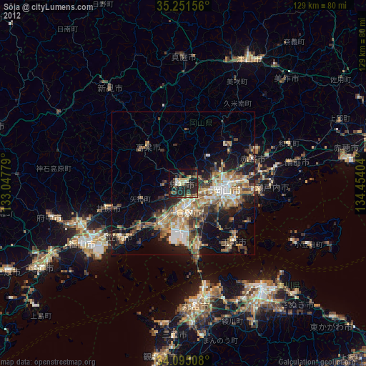
» Earth at Night: Flat Maps 2012, 2016