Toyohashi night lights from space
Night Light of Toyohashi (Aichi) from space (Japan) Src. Average luminocity for 10x10km area is 82.7949% and for 50x50km: 27.125%.
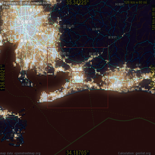
Analysis of Toyohashi night lights 2016
Square area 10x10 km:
 21.79%
90-99
28.39%80-89
11.36%70-79
6.96%60-69
19.6%50-59
10.81%40-49
1.1%30-39
0%20-29
0%10-19
0%0-9
0%Square area 50x50 km:
3.25%90-99
4.61%80-89
3.44%70-79
3.6%60-69
4.62%50-59
4.37%40-49
4.21%30-39
4.23%20-29
8.81%10-19
15.09%0-9
43.78%Clear (daylight) street map image can be seen on geolist.org.
Map coordinates:
35° 20' 32.1" North, 136° 40' 48.8" East
34° 46' 0" North, 137° 22' 60" East
34° 11' 13.4" North, 138° 5' 11.3" East
Some cities around Toyohashi sort by population:
• Hamamatsu
32.8 km =20.4 mi,  103°
103°
• Okazaki
28.4 km =17.6 mi,  315°
315°
• Toyokawa
5.8 km =3.6 mi,  15°
15°
• Nishio
32.4 km =20.1 mi,  290°
290°
• Gamagōri
15.6 km =9.7 mi,  298°
298°
• Tahara
15.4 km =9.6 mi,  223°
223°
• Shinshiro
18.3 km =11.4 mi,  35°
35°
• Kozakai-chō
4.3 km =2.7 mi,  328°
328°
1849846 (p: 378,374)
Sources (retrieved 2019-11-25):
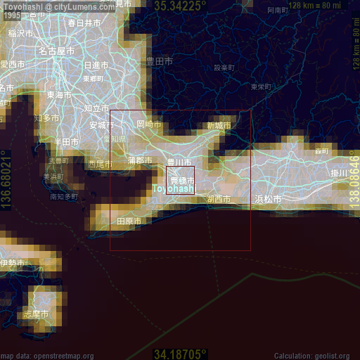
» NASA, Earths city lights 1995
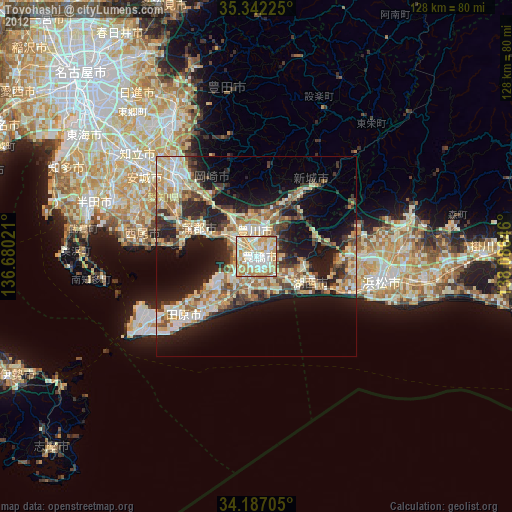
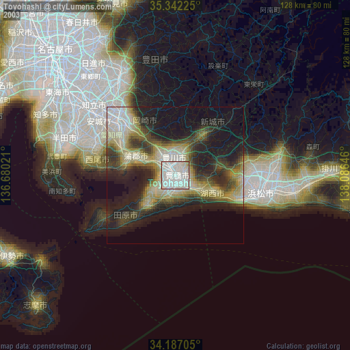
» NASA city lights 2003
» Earth at Night: Flat Maps 2012, 2016