Tamano night lights from space
Night Light of Tamano (Okayama) from space (Japan) Src. Average luminocity for 10x10km area is 14.4668% and for 50x50km: 21.8908%.
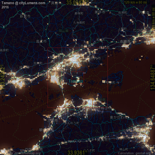
Analysis of Tamano night lights 2016
Square area 10x10 km:
 0%
0%90-99
1.92%80-89
1.4%70-79
1.75%60-69
1.22%50-59
2.45%40-49
3.67%30-39
2.62%20-29
2.1%10-19
6.64%0-9
76.22%Square area 50x50 km:
2.4%90-99
3.2%80-89
2.91%70-79
2.75%60-69
3.17%50-59
4.07%40-49
4.05%30-39
3.27%20-29
6.99%10-19
12.94%0-9
54.25%Clear (daylight) street map image can be seen on geolist.org.
Map coordinates:
35° 5' 41.2" North, 133° 14' 33.4" East
34° 31' 2.8" North, 133° 56' 44.7" East
33° 56' 10" North, 134° 38' 55.9" East
Some cities around Tamano sort by population:
• Okayama
14.8 km =9.2 mi,  355°
355°
• Kurashiki
18 km =11.2 mi,  294°
294°
• Takamatsu
22.6 km =14 mi,  154°
154°
• Marugame
30 km =18.6 mi,  209°
209°
• Sōja
25 km =15.5 mi,  314°
314°
• Sakaidechō
23.9 km =14.9 mi, 205°
• Shido
30 km =18.6 mi,  135°
135°
• Tonoshō
21 km =13 mi,  101°
101°
1850742 (p: 67,786)
Sources (retrieved 2019-11-25):
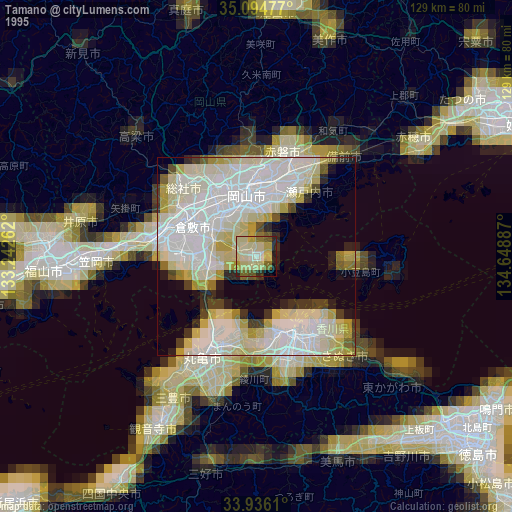
» NASA, Earths city lights 1995
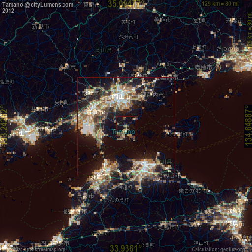
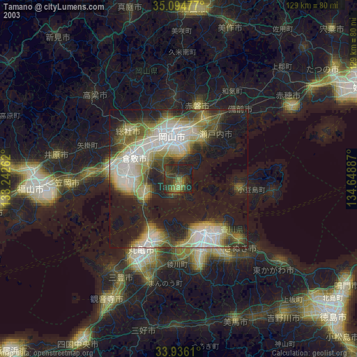
» NASA city lights 2003
» Earth at Night: Flat Maps 2012, 2016