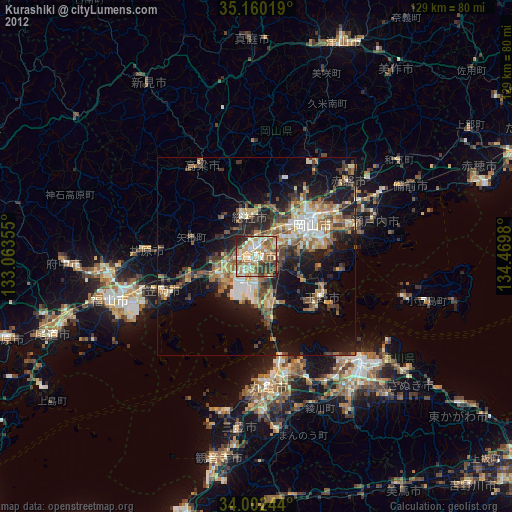
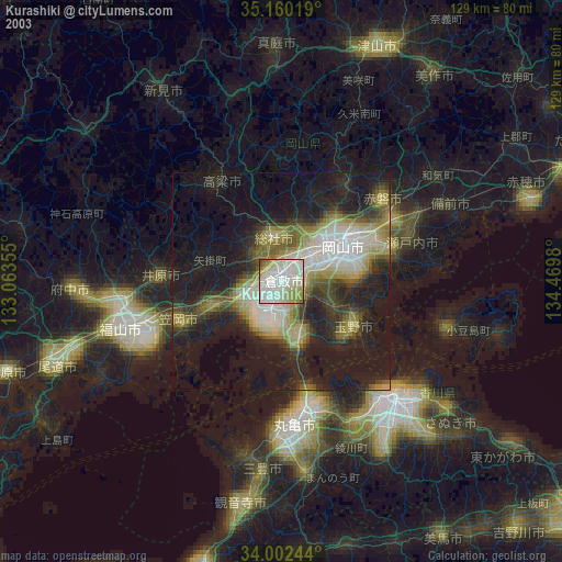
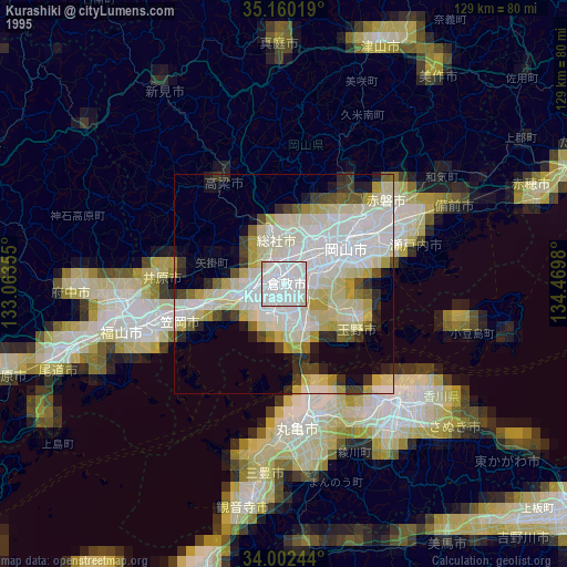
Kurashiki night lights from space
Night Light of Kurashiki (Okayama) from space (Japan) Src. Average luminocity for 10x10km area is 57.0787% and for 50x50km: 17.2174%.

Analysis of Kurashiki night lights 2016
Square area 10x10 km:
 4.37%
4.37%90-99
7.52%80-89
12.41%70-79
8.57%60-69
8.39%50-59
17.48%40-49
13.99%30-39
9.62%20-29
15.03%10-19
2.62%0-9
0%Square area 50x50 km:
1.68%90-99
2.18%80-89
2.36%70-79
2.13%60-69
2.49%50-59
3.17%40-49
3.3%30-39
2.76%20-29
5.76%10-19
10.42%0-9
63.74%Clear (daylight) street map image can be seen on geolist.org.
Map coordinates:
35° 9' 36.7" North, 133° 3' 48.8" East
34° 34' 60" North, 133° 46' 0" East
34° 0' 8.8" North, 134° 28' 11.3" East
Some cities around Kurashiki sort by population:
• Okayama
17 km =10.6 mi,  64°
64°
• Tamano
18 km =11.2 mi,  114°
114°
• Kasaoka
25.6 km =15.9 mi,  250°
250°
• Sōja
10.3 km =6.4 mi,  351°
351°
• Sakaidechō
29.7 km =18.5 mi,  167°
167°
• Ibara
27.5 km =17.1 mi,  273°
273°
• Takahashi
26.1 km =16.2 mi,  328°
328°
• Kamogatachō-kamogata
17 km =10.6 mi, 252°
1858311 (p: 437,581)
Sources (retrieved 2019-11-25):
» NASA, Earths city lights 1995
» NASA city lights 2003
» Earth at Night: Flat Maps 2012, 2016