Sakai night lights from space
Night Light of Sakai (Ōsaka) from space (Japan) Src. Average luminocity for 10x10km area is 95.5647% and for 50x50km: 59.9837%.
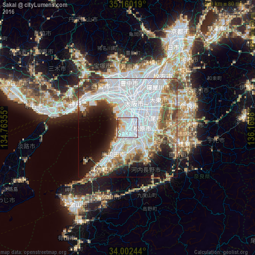
Analysis of Sakai night lights 2016
Square area 10x10 km:
 70.45%
90-99
15.91%80-89
5.07%70-79
1.75%60-69
3.67%50-59
1.57%40-49
1.57%30-39
0%20-29
0%10-19
0%0-9
0%Square area 50x50 km:
28.49%90-99
11.27%80-89
4.91%70-79
4.29%60-69
5.34%50-59
5.86%40-49
5.02%30-39
4.08%20-29
5.13%10-19
7.82%0-9
17.8%Clear (daylight) street map image can be seen on geolist.org.
Map coordinates:
35° 9' 36.7" North, 134° 45' 48.8" East
34° 34' 60" North, 135° 28' 0" East
34° 0' 8.8" North, 136° 10' 11.3" East
Some cities around Sakai sort by population:
• Osaka
12.7 km =7.9 mi,  14°
14°
• Yao
12.8 km =8 mi,  73°
73°
• Izumi
11.5 km =7.1 mi,  195°
195°
• Tondabayashichō
15.4 km =9.6 mi,  126°
126°
• Matsubara
7.9 km =4.9 mi,  103°
103°
• Izumiōtsu
11.1 km =6.9 mi,  213°
213°
• Kashihara
13.7 km =8.5 mi,  90°
90°
• Takaishi
8 km =5 mi, 202°
1853195 (p: 782,339)
Sources (retrieved 2019-11-25):
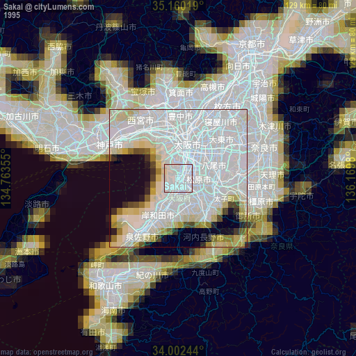
» NASA, Earths city lights 1995
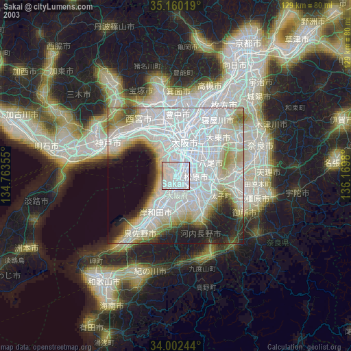
» NASA city lights 2003
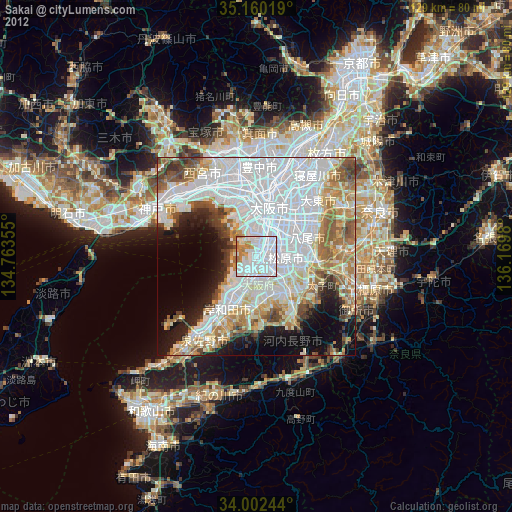
» Earth at Night: Flat Maps 2012, 2016