Kashihara night lights from space
Night Light of Kashihara (Ōsaka) from space (Japan) Src. Average luminocity for 10x10km area is 85.028% and for 50x50km: 63.084%.
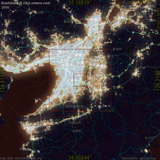
Analysis of Kashihara night lights 2016
Square area 10x10 km:
 36.19%
90-99
23.95%80-89
8.22%70-79
6.82%60-69
6.29%50-59
12.41%40-49
5.94%30-39
0.17%20-29
0%10-19
0%0-9
0%Square area 50x50 km:
27.55%90-99
10.98%80-89
6.47%70-79
5.56%60-69
7.77%50-59
6.88%40-49
4.88%30-39
3.45%20-29
5.18%10-19
8.92%0-9
12.35%Clear (daylight) street map image can be seen on geolist.org.
Map coordinates:
35° 9' 36.7" North, 134° 54' 48.8" East
34° 34' 60" North, 135° 37' 0" East
34° 0' 8.8" North, 136° 19' 11.3" East
Some cities around Kashihara sort by population:
• Osaka
16.1 km =10 mi,  319°
319°
• Sakai
13.7 km =8.5 mi,  270°
270°
• Yao
4 km =2.5 mi,  337°
337°
• Tondabayashichō
9.3 km =5.8 mi,  188°
188°
• Matsubara
6.4 km =4 mi,  253°
253°
• Daitōchō
14.5 km =9 mi,  1°
1°
• Ikoma
13.5 km =8.4 mi,  34°
34°
• Hōryūji
11.5 km =7.1 mi,  73°
73°
1859952 (p: 79,058)
Sources (retrieved 2019-11-25):
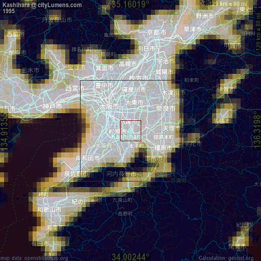
» NASA, Earths city lights 1995
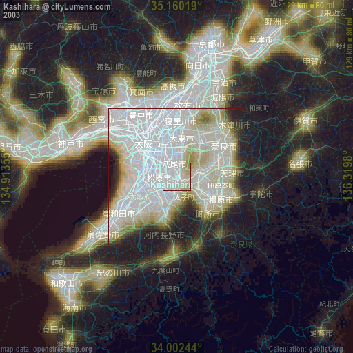
» NASA city lights 2003
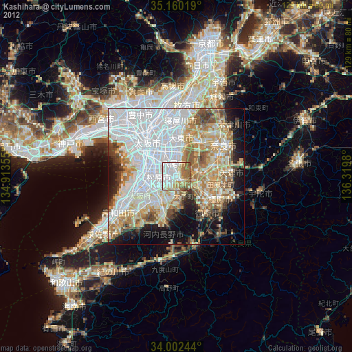
» Earth at Night: Flat Maps 2012, 2016