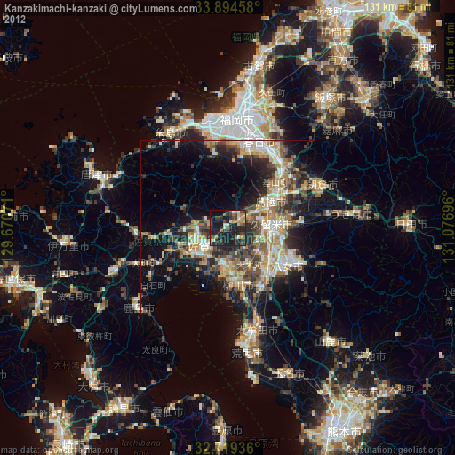
Kanzakimachi-kanzaki night lights from space
Night Light of Kanzakimachi-kanzaki (Saga) from space (Japan) Src. Average luminocity for 10x10km area is 26.9091% and for 50x50km: 22.1691%.
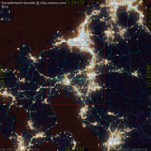
Analysis of Kanzakimachi-kanzaki night lights 2016
Square area 10x10 km:
 0%
0%90-99
2.62%80-89
3.67%70-79
3.85%60-69
6.12%50-59
3.15%40-49
1.92%30-39
4.9%20-29
12.41%10-19
48.25%0-9
13.11%Square area 50x50 km:
1.53%90-99
3.14%80-89
2.81%70-79
2.62%60-69
3.55%50-59
4.29%40-49
3.32%30-39
4.8%20-29
9.23%10-19
16.25%0-9
48.45%Clear (daylight) street map image can be seen on geolist.org.
Map coordinates:
33° 53' 40.5" North, 129° 40' 14.6" East
33° 18' 32.2" North, 130° 22' 25.8" East
32° 43' 9.7" North, 131° 4' 37.1" East
Some cities around Kanzakimachi-kanzaki sort by population:
• Kurume
13.3 km =8.3 mi,  86°
86°
• Saga
10.9 km =6.8 mi,  219°
219°
• Chikushino-shi
24.6 km =15.3 mi,  32°
32°
• Dazaifu
26.6 km =16.5 mi, 31°
• Tosu
14.7 km =9.1 mi,  64°
64°
• Yanagawa
16 km =9.9 mi,  171°
171°
• Ōkawa
11.5 km =7.1 mi,  179°
179°
• Setakamachi-takayanagi
19.8 km =12.3 mi,  154°
154°
1860095 (p: 20,172)
Sources (retrieved 2019-11-25):
» Earth at Night: Flat Maps 2012, 2016