Ōkawa night lights from space
Night Light of Ōkawa (Fukuoka) from space (Japan) Src. Average luminocity for 10x10km area is 38.5402% and for 50x50km: 19.3381%.
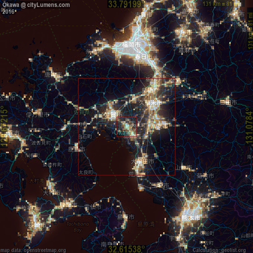

Analysis of Ōkawa night lights 2016
Square area 10x10 km:
 0.87%
0.87%90-99
3.85%80-89
5.77%70-79
3.32%60-69
5.94%50-59
13.11%40-49
8.22%30-39
12.41%20-29
15.73%10-19
26.22%0-9
4.55%Square area 50x50 km:
1.13%90-99
2.56%80-89
2.53%70-79
2.52%60-69
3.25%50-59
3.7%40-49
3.03%30-39
4%20-29
7.51%10-19
15.18%0-9
54.58%Clear (daylight) street map image can be seen on geolist.org.
Map coordinates:
33° 47' 31.2" North, 129° 40' 19.7" East
33° 12' 20.4" North, 130° 22' 31" East
32° 36' 55.4" North, 131° 4' 42.2" East
Some cities around Ōkawa sort by population:
• Kurume
18 km =11.2 mi,  46°
46°
• Saga
7.6 km =4.7 mi,  293°
293°
• Ōmuta
20.4 km =12.7 mi,  160°
160°
• Tosu
22.2 km =13.8 mi,  36°
36°
• Yanagawa
4.9 km =3 mi,  152°
152°
• Kashima
28.7 km =17.8 mi,  247°
247°
• Setakamachi-takayanagi
10.5 km =6.5 mi,  127°
127°
• Kanzakimachi-kanzaki
11.5 km =7.1 mi,  359°
359°
1854405 (p: 39,223)
Sources (retrieved 2019-11-25):
» Earth at Night: Flat Maps 2012, 2016