Owase night lights from space
Night Light of Owase (Mie) from space (Japan) Src. Average luminocity for 10x10km area is 5.3112% and for 50x50km: 0.3506%.
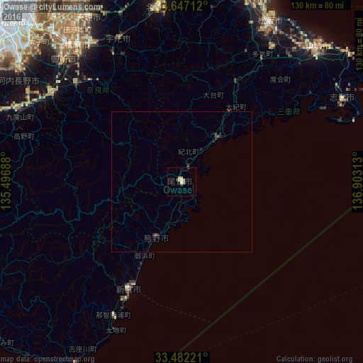
Analysis of Owase night lights 2016
Square area 10x10 km:
 0%
0%90-99
0.7%80-89
1.92%70-79
1.4%60-69
0.87%50-59
0%40-49
0.17%30-39
0.17%20-29
1.4%10-19
0%0-9
93.36%Square area 50x50 km:
0%90-99
0.03%80-89
0.08%70-79
0.06%60-69
0.04%50-59
0.04%40-49
0.04%30-39
0.11%20-29
0.21%10-19
0.09%0-9
99.32%Clear (daylight) street map image can be seen on geolist.org.
Map coordinates:
34° 38' 49.6" North, 135° 29' 48.8" East
34° 4' 0" North, 136° 12' 0" East
33° 28' 56" North, 136° 54' 11.3" East
Some cities around Owase sort by population:
• Sakurai
57.9 km =36 mi,  326°
326°
• Hashimoto
60.4 km =37.5 mi,  297°
297°
• Gojō
55.7 km =34.6 mi, 304°
• Gose
60.5 km =37.6 mi,  314°
314°
• Shingū
42.1 km =26.2 mi,  208°
208°
• Haibara-akanedai
56.7 km =35.2 mi,  336°
336°
• Yoshino-chō
48.3 km =30 mi,  319°
319°
• Kōya
55.6 km =34.5 mi,  287°
287°
1853514 (p: 22,038)
Sources (retrieved 2019-11-25):
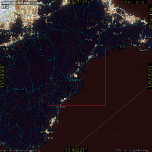
» Earth at Night: Flat Maps 2012, 2016