Sakurai night lights from space
Night Light of Sakurai (Nara) from space (Japan) Src. Average luminocity for 10x10km area is 34.3619% and for 50x50km: 26.7552%.
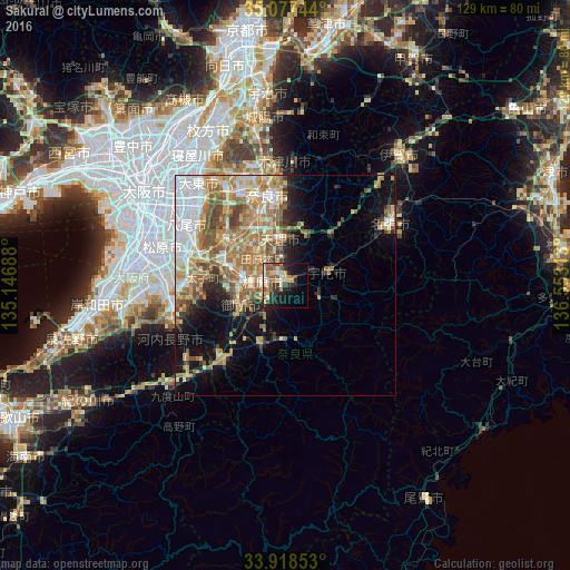
Analysis of Sakurai night lights 2016
Square area 10x10 km:
 2.27%
2.27%90-99
4.2%80-89
6.47%70-79
4.37%60-69
6.29%50-59
8.22%40-49
5.42%30-39
7.34%20-29
8.04%10-19
19.06%0-9
28.32%Square area 50x50 km:
5.03%90-99
3.98%80-89
4.1%70-79
3.98%60-69
6.23%50-59
4.97%40-49
2.84%30-39
1.94%20-29
3.52%10-19
7.62%0-9
55.8%Clear (daylight) street map image can be seen on geolist.org.
Map coordinates:
35° 4' 38.8" North, 135° 8' 48.8" East
34° 30' 0" North, 135° 51' 0" East
33° 55' 6.7" North, 136° 33' 11.3" East
Some cities around Sakurai sort by population:
• Nara-shi
21 km =13 mi,  348°
348°
• Kashihara-shi
5.3 km =3.3 mi,  280°
280°
• Tenri
9.4 km =5.8 mi, 350°
• Gose
12.1 km =7.5 mi,  242°
242°
• Tawaramoto
8 km =5 mi,  319°
319°
• Hōryūji
16.2 km =10.1 mi, 320°
• Haibara-akanedai
9.9 km =6.2 mi,  67°
67°
• Yoshino-chō
11.6 km =7.2 mi,  176°
176°
1853066 (p: 62,964)
Sources (retrieved 2019-11-25):
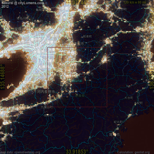
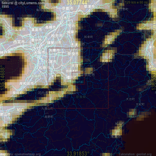
» NASA, Earths city lights 1995
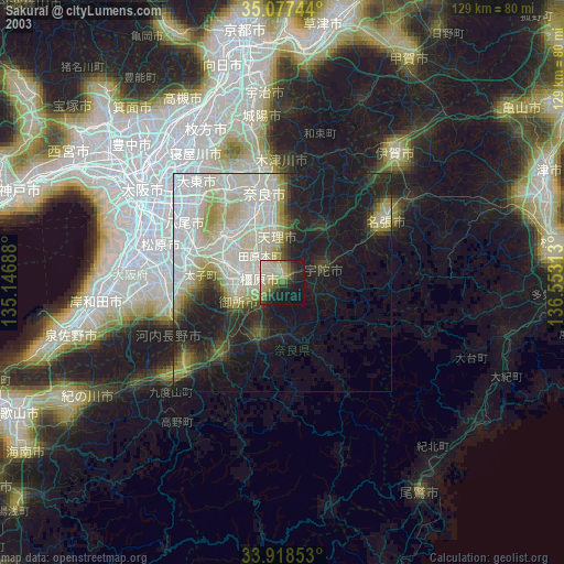
» NASA city lights 2003
» Earth at Night: Flat Maps 2012, 2016