Onomichi night lights from space
Night Light of Onomichi (Hiroshima) from space (Japan) Src. Average luminocity for 10x10km area is 32.9773% and for 50x50km: 8.4048%.
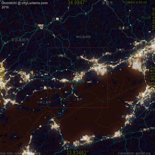
Analysis of Onomichi night lights 2016
Square area 10x10 km:
 0.35%
0.35%90-99
2.1%80-89
4.37%70-79
5.77%60-69
8.74%50-59
12.06%40-49
6.29%30-39
3.32%20-29
4.55%10-19
31.12%0-9
21.33%Square area 50x50 km:
0.64%90-99
0.98%80-89
0.93%70-79
1.05%60-69
1.49%50-59
1.6%40-49
1.57%30-39
1.16%20-29
2.38%10-19
5.45%0-9
82.75%Clear (daylight) street map image can be seen on geolist.org.
Map coordinates:
34° 59' 40.9" North, 132° 29' 48.8" East
34° 25' 0" North, 133° 12' 0" East
33° 50' 4.6" North, 133° 54' 11.3" East
Some cities around Onomichi sort by population:
• Fukuyama
17 km =10.6 mi,  64°
64°
• Mihara
10.9 km =6.8 mi,  260°
260°
• Kasaoka
29.6 km =18.4 mi,  70°
70°
• Fuchūchō
17.7 km =11 mi,  10°
10°
• Kannabechō-yahiro
25.4 km =15.8 mi,  51°
51°
• Takehara
27.4 km =17 mi,  251°
251°
• Innoshima
14.9 km =9.3 mi,  185°
185°
• Shin’ichi
16.8 km =10.4 mi,  23°
23°
1853992 (p: 90,936)
Sources (retrieved 2019-11-25):
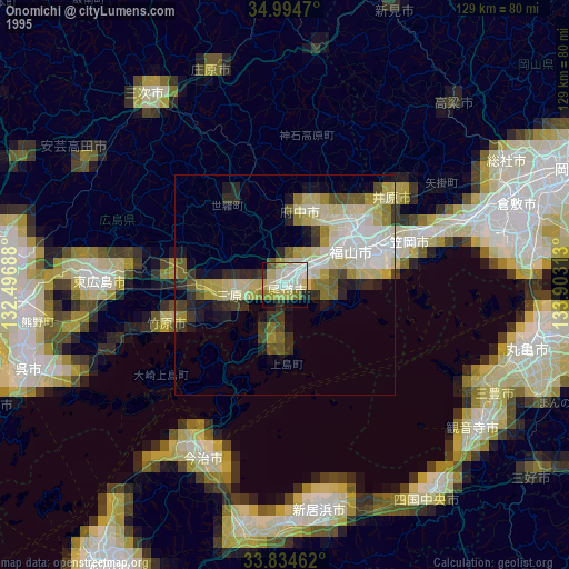
» NASA, Earths city lights 1995
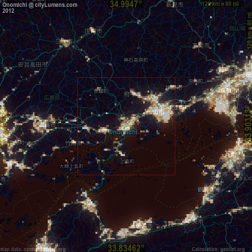
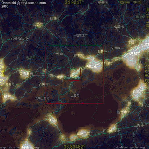
» NASA city lights 2003
» Earth at Night: Flat Maps 2012, 2016