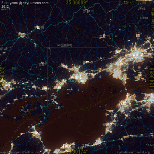
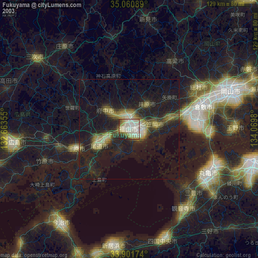
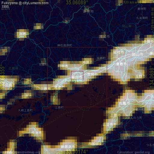
Fukuyama night lights from space
Night Light of Fukuyama (Hiroshima) from space (Japan) Src. Average luminocity for 10x10km area is 52.7133% and for 50x50km: 8.6474%.
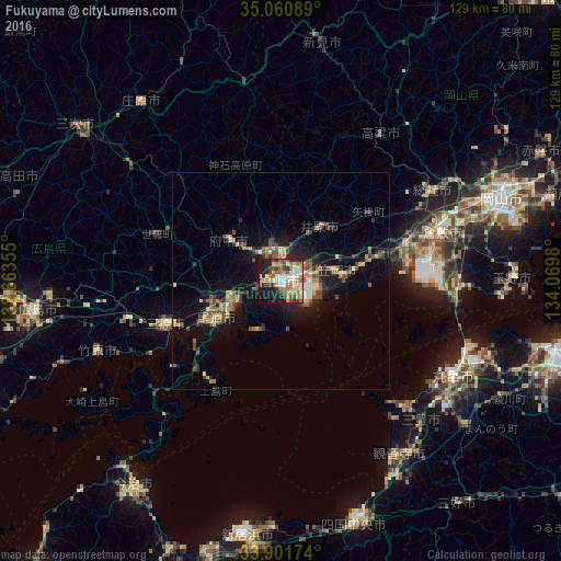
Analysis of Fukuyama night lights 2016
Square area 10x10 km:
 8.04%
8.04%90-99
11.36%80-89
5.24%70-79
6.12%60-69
13.29%50-59
9.09%40-49
6.12%30-39
7.87%20-29
11.19%10-19
18.71%0-9
2.97%Square area 50x50 km:
0.65%90-99
0.9%80-89
0.96%70-79
1%60-69
1.51%50-59
1.74%40-49
1.62%30-39
1.19%20-29
2.38%10-19
6.53%0-9
81.53%Clear (daylight) street map image can be seen on geolist.org.
Map coordinates:
35° 3' 39.2" North, 132° 39' 48.8" East
34° 28' 60" North, 133° 22' 0" East
33° 54' 6.3" North, 134° 4' 11.3" East
Some cities around Fukuyama sort by population:
• Onomichi
17 km =10.6 mi,  244°
244°
• Mihara
27.6 km =17.1 mi,  250°
250°
• Kasaoka
12.8 km =8 mi,  78°
78°
• Fuchūchō
15.7 km =9.8 mi,  309°
309°
• Kannabechō-yahiro
9.5 km =5.9 mi,  29°
29°
• Ibara
15.9 km =9.9 mi,  35°
35°
• Shin’ichi
11.7 km =7.3 mi, 313°
• Kamogatachō-kamogata
21.3 km =13.2 mi,  73°
73°
1863917 (p: 383,298)
Sources (retrieved 2019-11-25):
» NASA, Earths city lights 1995
» NASA city lights 2003
» Earth at Night: Flat Maps 2012, 2016