Ogawa night lights from space
Night Light of Ogawa (Saitama) from space (Japan) Src. Average luminocity for 10x10km area is 29.9011% and for 50x50km: 36.9124%.

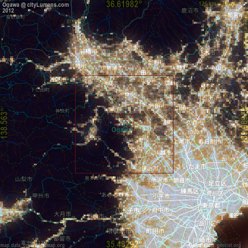
Analysis of Ogawa night lights 2016
Square area 10x10 km:
 0.18%
0.18%90-99
4.03%80-89
1.65%70-79
4.4%60-69
5.86%50-59
2.75%40-49
9.52%30-39
7.14%20-29
20.88%10-19
24.54%0-9
19.05%Square area 50x50 km:
2.8%90-99
6.33%80-89
4.3%70-79
5.32%60-69
7.8%50-59
7.6%40-49
9.58%30-39
10.04%20-29
8.46%10-19
6.15%0-9
31.62%Clear (daylight) street map image can be seen on geolist.org.
Map coordinates:
36° 37' 11.4" North, 138° 33' 46.8" East
36° 3' 12.3" North, 139° 15' 58" East
35° 28' 58.5" North, 139° 58' 9.3" East
Some cities around Ogawa sort by population:
• Kumagaya
14.4 km =8.9 mi,  50°
50°
• Fukayachō
16.4 km =10.2 mi,  5°
5°
• Sakado
15.4 km =9.6 mi,  134°
134°
• Chichibu
18.5 km =11.5 mi,  247°
247°
• Morohongō
13.6 km =8.5 mi,  165°
165°
• Yorii
9.5 km =5.9 mi,  316°
316°
• Fukiage-fujimi
17.3 km =10.7 mi,  72°
72°
• Kodamachō-kodamaminami
19 km =11.8 mi, 320°
1854665 (p: 37,443)
Sources (retrieved 2019-11-25):
» Earth at Night: Flat Maps 2012, 2016