Mori night lights from space
Night Light of Mori (Shizuoka) from space (Japan) Src. Average luminocity for 10x10km area is 17.8407% and for 50x50km: 20.7758%.
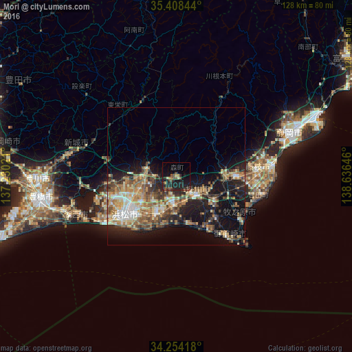
Analysis of Mori night lights 2016
Square area 10x10 km:
 0%
0%90-99
0.37%80-89
1.83%70-79
2.2%60-69
0.73%50-59
4.03%40-49
4.76%30-39
4.76%20-29
11.17%10-19
25.27%0-9
44.87%Square area 50x50 km:
1.75%90-99
3.04%80-89
2.99%70-79
3.11%60-69
3.65%50-59
3.9%40-49
3.76%30-39
3.02%20-29
5.9%10-19
13.55%0-9
55.34%Clear (daylight) street map image can be seen on geolist.org.
Map coordinates:
35° 24' 30.4" North, 137° 13' 48.8" East
34° 49' 60" North, 137° 55' 60" East
34° 15' 15" North, 138° 38' 11.3" East
Some cities around Mori sort by population:
• Hamamatsu
23.5 km =14.6 mi,  230°
230°
• Iwata
16.7 km =10.4 mi,  207°
207°
• Hamakita
14.2 km =8.8 mi,  254°
254°
• Kakegawa
10.6 km =6.6 mi,  134°
134°
• Shimada
22.9 km =14.2 mi,  94°
94°
• Fukuroi
9.4 km =5.8 mi,  189°
189°
• Sagara
29.8 km =18.5 mi,  123°
123°
• Kanaya
17.8 km =11.1 mi, 94°
1856586 (p: 20,280)
Sources (retrieved 2019-11-25):
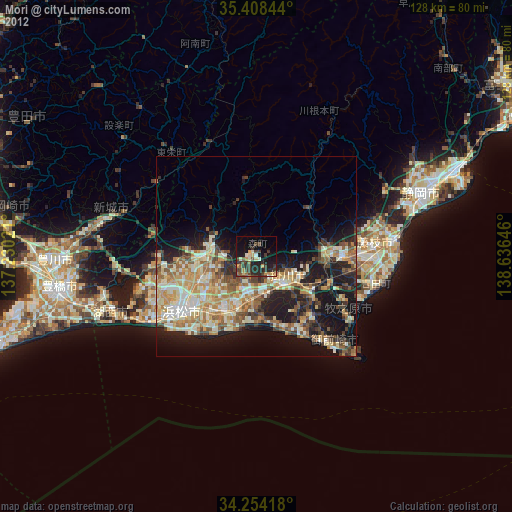
» Earth at Night: Flat Maps 2012, 2016