Kakegawa night lights from space
Night Light of Kakegawa (Shizuoka) from space (Japan) Src. Average luminocity for 10x10km area is 40.9652% and for 50x50km: 19.9707%.
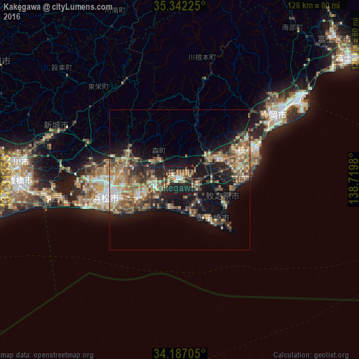
Analysis of Kakegawa night lights 2016
Square area 10x10 km:
 2.93%
2.93%90-99
5.86%80-89
3.3%70-79
8.24%60-69
9.16%50-59
5.13%40-49
5.86%30-39
5.86%20-29
19.96%10-19
33.7%0-9
0%Square area 50x50 km:
1.06%90-99
2.63%80-89
2.76%70-79
3%60-69
3.41%50-59
4.65%40-49
4.18%30-39
2.98%20-29
5.78%10-19
13.74%0-9
55.81%Clear (daylight) street map image can be seen on geolist.org.
Map coordinates:
35° 20' 32.1" North, 137° 18' 48.8" East
34° 46' 0" North, 138° 1' 0" East
34° 11' 13.4" North, 138° 43' 11.3" East
Some cities around Kakegawa sort by population:
• Fujieda
25.4 km =15.8 mi,  64°
64°
• Iwata
16.9 km =10.5 mi,  244°
244°
• Hamakita
21.6 km =13.4 mi,  279°
279°
• Shimada
16.2 km =10.1 mi,  69°
69°
• Fukuroi
9.3 km =5.8 mi,  258°
258°
• Sagara
19.4 km =12.1 mi,  117°
117°
• Kanaya
11.8 km =7.3 mi, 59°
• Mori
10.6 km =6.6 mi,  314°
314°
1860728 (p: 84,004)
Sources (retrieved 2019-11-25):
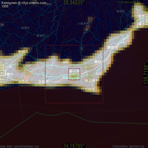
» NASA, Earths city lights 1995
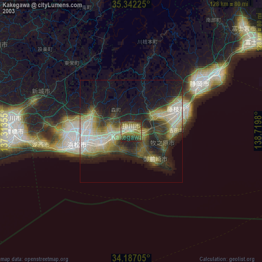
» NASA city lights 2003
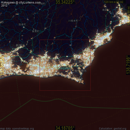
» Earth at Night: Flat Maps 2012, 2016