Marumori night lights from space
Night Light of Marumori (Miyagi) from space (Japan) Src. Average luminocity for 10x10km area is 2.375% and for 50x50km: 7.8868%.
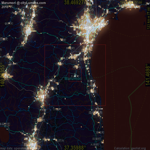
Analysis of Marumori night lights 2016
Square area 10x10 km:
 0.32%
0.32%90-99
0.32%80-89
0%70-79
0%60-69
0%50-59
0%40-49
0.49%30-39
0.65%20-29
2.11%10-19
0%0-9
96.1%Square area 50x50 km:
0.34%90-99
1.03%80-89
1.03%70-79
0.9%60-69
0.94%50-59
1.25%40-49
1.38%30-39
1.48%20-29
2.35%10-19
7.15%0-9
82.15%Clear (daylight) street map image can be seen on geolist.org.
Map coordinates:
38° 28' 9.4" North, 140° 3' 48.8" East
37° 55' 0" North, 140° 46' 0" East
37° 21' 35.6" North, 141° 28' 11.3" East
Some cities around Marumori sort by population:
• Fukushima
32.2 km =20 mi,  234°
234°
• Iwanuma
22.4 km =13.9 mi,  21°
21°
• Shiroishi
16.2 km =10.1 mi,  306°
306°
• Watari
15.1 km =9.4 mi,  29°
29°
• Kakuda
6.4 km =4 mi,  4°
4°
• Hobaramachi
22 km =13.7 mi,  239°
239°
• Ōkawara
15.1 km =9.4 mi,  348°
348°
• Yanagawamachi-saiwaichō
16.4 km =10.2 mi, 243°
2112008 (p: 16,752)
Sources (retrieved 2019-11-25):
» Earth at Night: Flat Maps 2012, 2016