Kawasaki night lights from space
Night Light of Kawasaki (Kanagawa) from space (Japan) Src. Average luminocity for 10x10km area is 97.4817% and for 50x50km: 69.8699%.
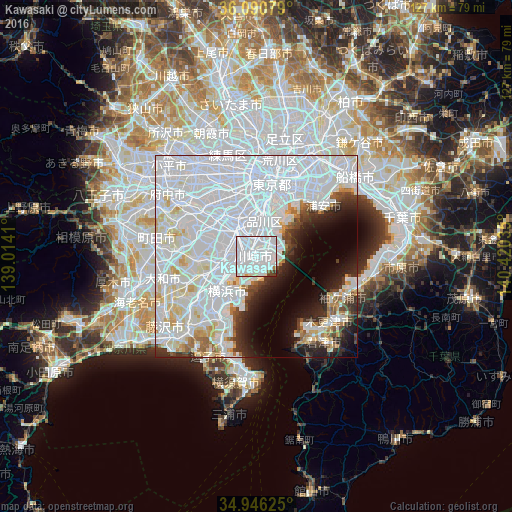
Analysis of Kawasaki night lights 2016
Square area 10x10 km:
 81.5%
81.5%90-99
13.74%80-89
0.37%70-79
0.92%60-69
0.37%50-59
0.92%40-49
1.1%30-39
1.1%20-29
0%10-19
0%0-9
0%Square area 50x50 km:
42.28%90-99
15.62%80-89
4.46%70-79
2.59%60-69
2.15%50-59
1.57%40-49
2.16%30-39
2.97%20-29
4.96%10-19
6.27%0-9
14.98%Clear (daylight) street map image can be seen on geolist.org.
Map coordinates:
36° 5' 26.8" North, 139° 0' 50.8" East
35° 31' 14" North, 139° 43' 2" East
34° 56' 46.5" North, 140° 25' 13.3" East
Some cities around Kawasaki sort by population:
• Tokyo
18.9 km =11.7 mi,  353°
353°
• Yokohama
11.5 km =7.1 mi,  212°
212°
• Machida
24.2 km =15 mi,  275°
275°
• Chōfu
21.7 km =13.5 mi,  315°
315°
• Kamirenjaku
24.3 km =15.1 mi, 322°
• Urayasu
22.8 km =14.2 mi,  42°
42°
• Kisarazu
24.8 km =15.4 mi,  128°
128°
• Kimitsu
23.5 km =14.6 mi,  143°
143°
1859642 (p: 1,306,785)
Sources (retrieved 2019-11-25):
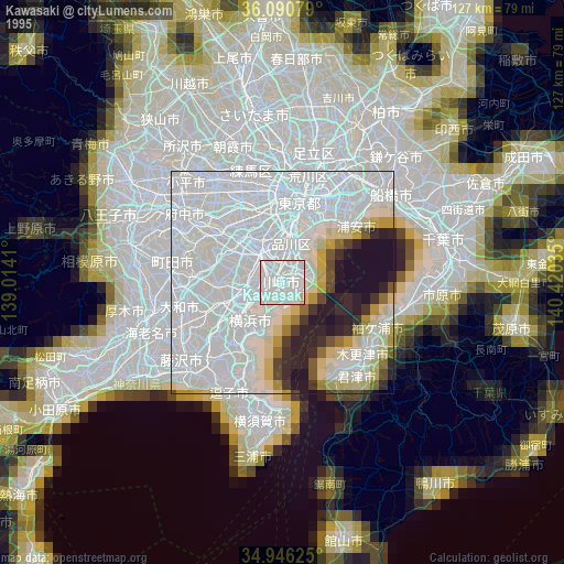
» NASA, Earths city lights 1995
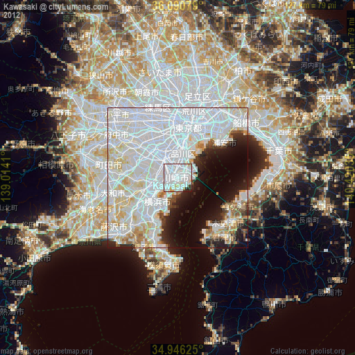
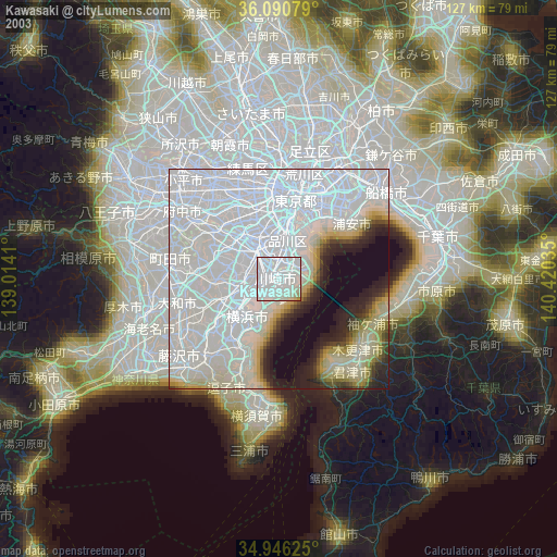
» NASA city lights 2003
» Earth at Night: Flat Maps 2012, 2016