Kanoya night lights from space
Night Light of Kanoya (Kagoshima) from space (Japan) Src. Average luminocity for 10x10km area is 28.3112% and for 50x50km: 3.6713%.
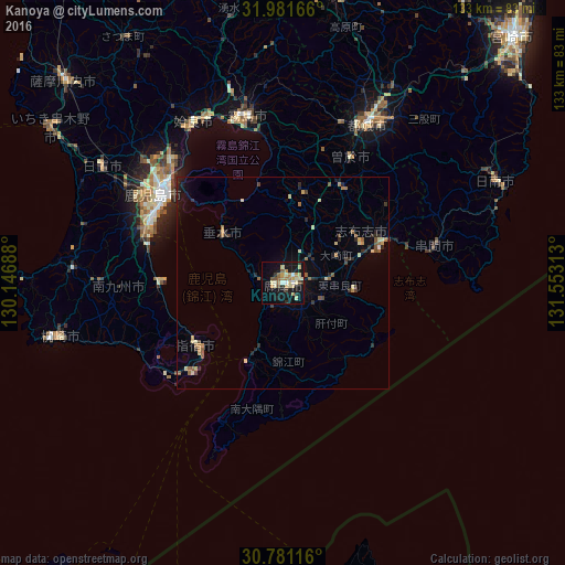
Analysis of Kanoya night lights 2016
Square area 10x10 km:
 0.87%
0.87%90-99
5.94%80-89
6.47%70-79
4.9%60-69
3.67%50-59
2.27%40-49
2.8%30-39
1.75%20-29
3.85%10-19
33.92%0-9
33.57%Square area 50x50 km:
0.04%90-99
0.4%80-89
0.71%70-79
0.46%60-69
0.55%50-59
0.68%40-49
0.35%30-39
0.42%20-29
1.06%10-19
2.34%0-9
93%Clear (daylight) street map image can be seen on geolist.org.
Map coordinates:
31° 58' 54" North, 130° 8' 48.8" East
31° 22' 60" North, 130° 51' 0" East
30° 46' 52.2" North, 131° 33' 11.3" East
Some cities around Kanoya sort by population:
• Kagoshima
35 km =21.7 mi,  305°
305°
• Kokubu-matsuki
39.7 km =24.7 mi,  348°
348°
• Hamanoichi
38.7 km =24 mi,  343°
343°
• Ibusuki
25.3 km =15.7 mi,  228°
228°
• Kushima
38.9 km =24.2 mi,  72°
72°
• Sueyoshichō-ninokata
33.6 km =20.9 mi,  28°
28°
• Tarumizu
18.1 km =11.2 mi, 308°
• Shibushi
26 km =16.2 mi, 66°
1860112 (p: 82,335)
Sources (retrieved 2019-11-25):
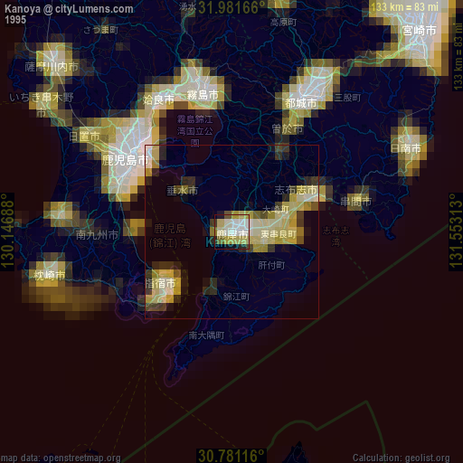
» NASA, Earths city lights 1995
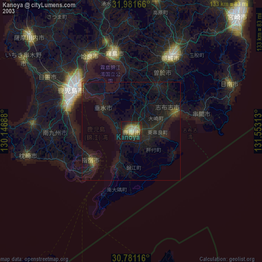
» NASA city lights 2003
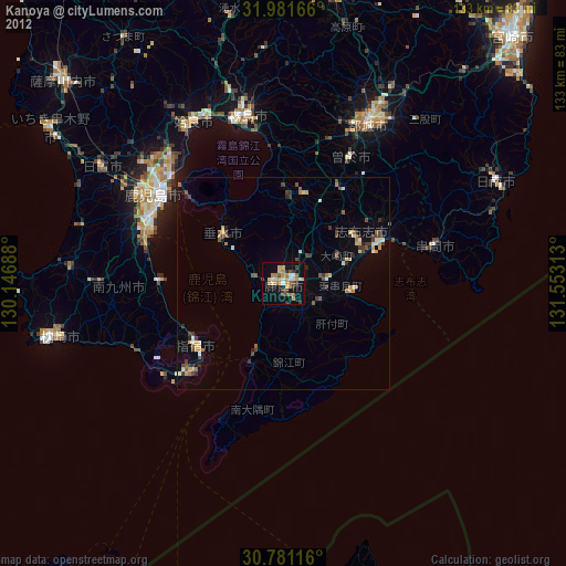
» Earth at Night: Flat Maps 2012, 2016