Iwade night lights from space
Night Light of Iwade (Wakayama) from space (Japan) Src. Average luminocity for 10x10km area is 43.4341% and for 50x50km: 19.4362%.
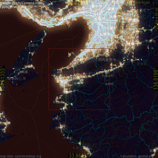
Analysis of Iwade night lights 2016
Square area 10x10 km:
 0%
0%90-99
3.85%80-89
10.07%70-79
5.49%60-69
8.61%50-59
13.55%40-49
7.51%30-39
9.34%20-29
21.06%10-19
17.77%0-9
2.75%Square area 50x50 km:
2.01%90-99
2.59%80-89
2.87%70-79
2.7%60-69
2.75%50-59
3.62%40-49
3.62%30-39
2.53%20-29
5.88%10-19
12.47%0-9
58.94%Clear (daylight) street map image can be seen on geolist.org.
Map coordinates:
34° 49' 45" North, 134° 36' 48.8" East
34° 15' 0" North, 135° 19' 0" East
33° 40' 0.5" North, 136° 1' 11.3" East
Some cities around Iwade sort by population:
• Minato
15.8 km =9.8 mi,  255°
255°
• Wakayama
13.9 km =8.6 mi, 262°
• Kishiwada
24.5 km =15.2 mi,  10°
10°
• Izumi
28.1 km =17.5 mi,  22°
22°
• Izumisano
18.5 km =11.5 mi,  0°
0°
• Kaizuka
22.4 km =13.9 mi, 7°
• Kainan
14.4 km =8.9 mi,  220°
220°
• Tajiri
20.7 km =12.9 mi,  341°
341°
1861244 (p: 55,633)
Sources (retrieved 2019-11-25):
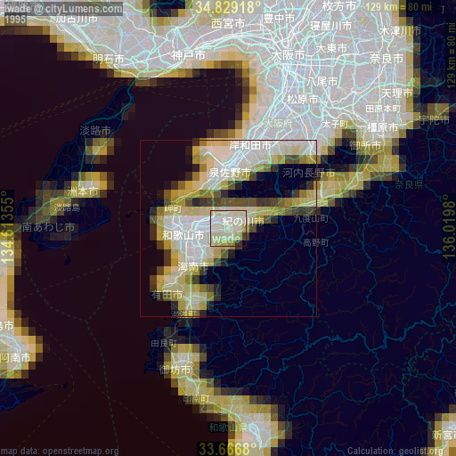
» NASA, Earths city lights 1995
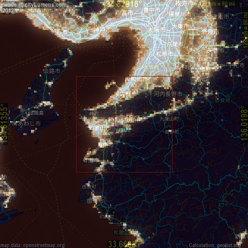
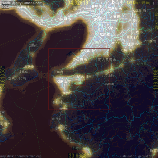
» NASA city lights 2003
» Earth at Night: Flat Maps 2012, 2016